")
")
")
DJI Store Madrid & Support Center Stockrc

9:00-14:00 and 16:30-19:30
Phone: 0034 91 851 20 96


Now: American Express
![]()
Redsys (Visa/MasterCard/4B/ServiRed)

Paypal
![]()
web optimized for Mobile


DJI Madrid & OFFICIAL Support Center P4 Multispectral P4 Multispectral + D-RTK 2 High Precision GNSS Mobile Station Combo
DJI Madrid & OFFICIAL Support Center P4 Multispectral P4 Multispectral
DJI Madrid & OFFICIAL Support Center Phantom 4 RTK D-RTK High Precision GNSS Mobile Station
DJI Madrid & OFFICIAL Support Center Matrice 210-200 / V2 HPRC6500W for DJI D-RTK2
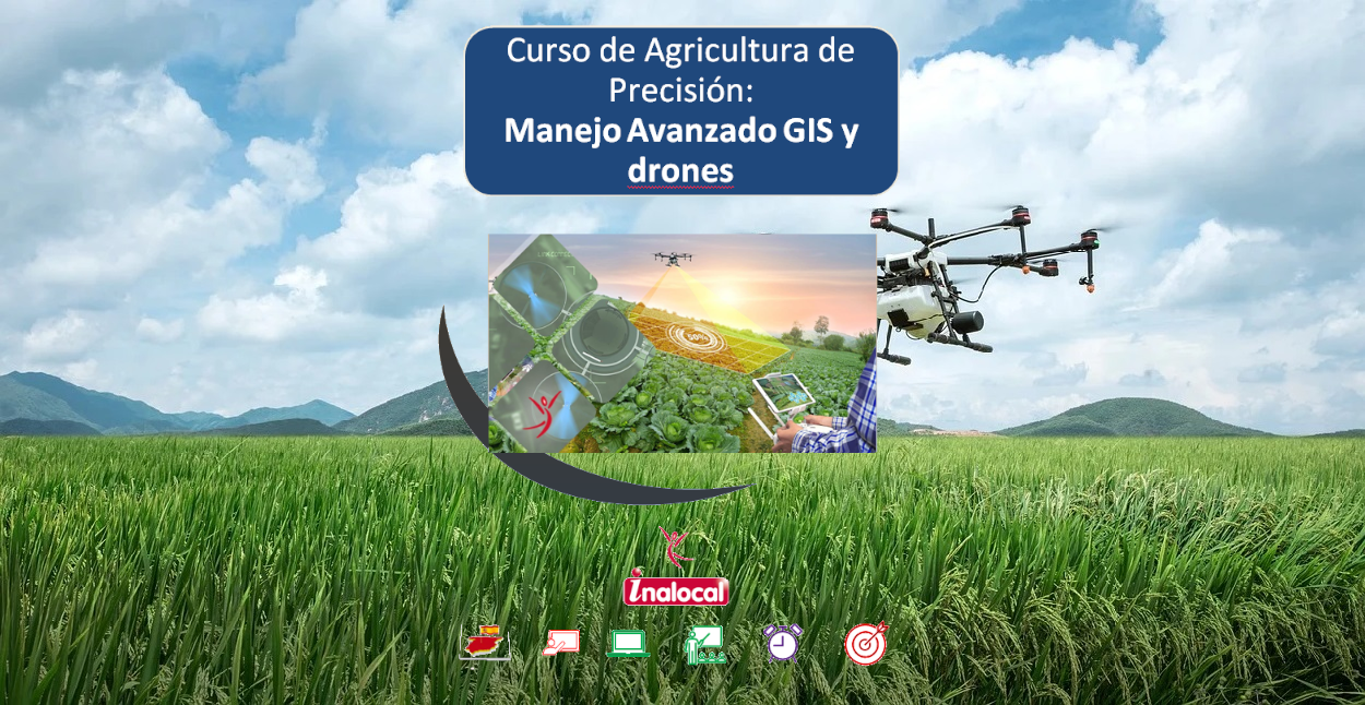
DJI Madrid & OFFICIAL Support Center P4 Multispectral Precision Agriculture Course: Advanced GIS and Drone Management
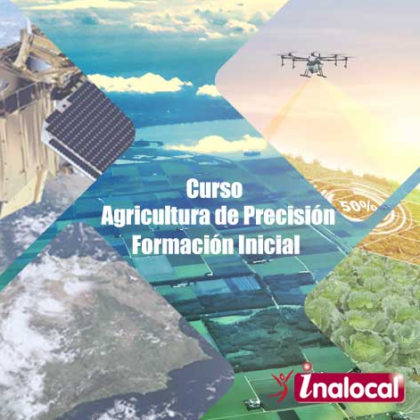
DJI Madrid & OFFICIAL Support Center P4 Multispectral Precision Agriculture Course: Introduction to GIS and Drones
DJI Madrid & OFFICIAL Support Center Matrice 350 RTK / 300 RTK D-RTK 2 base station tripod
DJI Madrid & OFFICIAL Support Center Phantom 4 Phantom 4 Series - Intelligent Flight Battery (High Capacity)
DJI Madrid & OFFICIAL Support Center Phantom 4 4 in 1 Multi Intelligent Battery Charger for DJI Phantom 4/Pro/Adv
DJI Madrid & OFFICIAL Support Center Phantom 4 Phantom 4 Part104 Battery charger 160W (Without AC cable)
P4 Multispectral + D-RTK 2 High Precision GNSS Mobile Station Combo
Currently unavailable
Notify on availability


P4 Multispectral + D-RTK 2 High Precision GNSS Mobile Station Combo
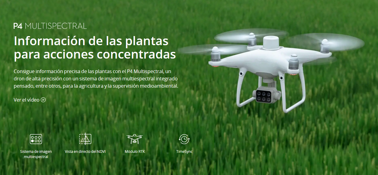
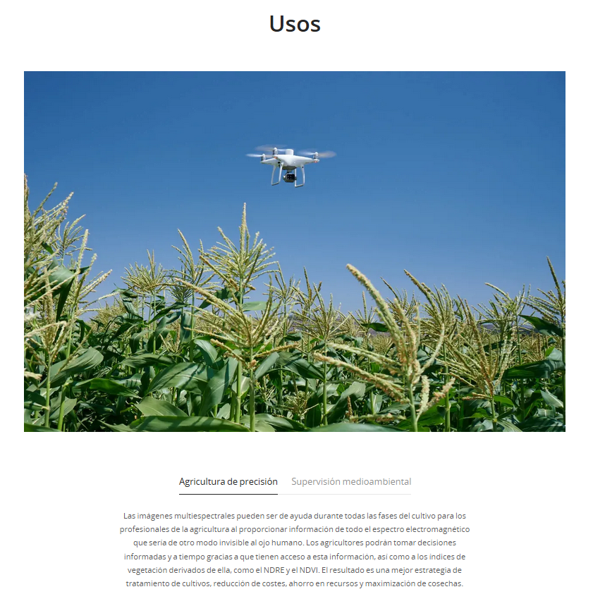
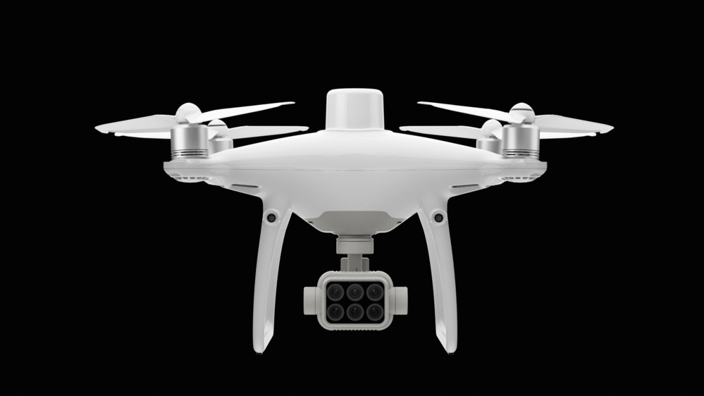
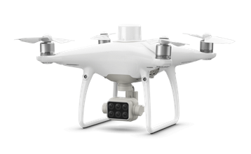
DJI introduces the Phantom 4 Multispectral, aimed at precision agriculture and land management. According to the drone manufacturer, this will be its first drone with an integrated multispectral camera, built with the aim of helping to solve the current problems farmers face in a more efficient way.
DJI Phantom 4 Multispectral
DJI, the undisputed leader in civil drones and aerial imaging technology, is setting a new standard for easy-to-use agricultural drones with the Phantom 4 Multispectral, the company's first drone to already integrate a high-quality multispectral camera and combine it with RTK technology for more accurate data.
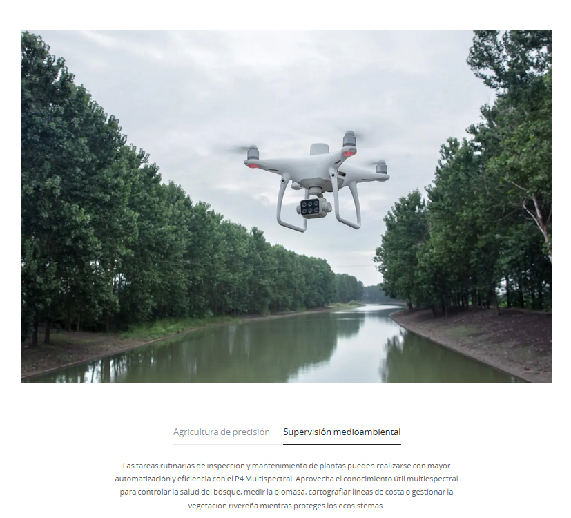
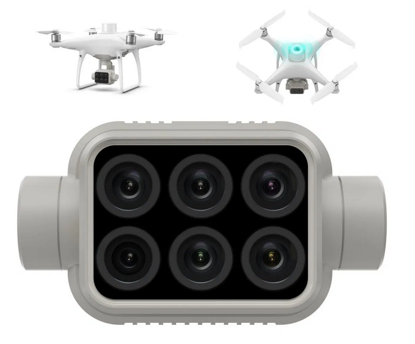
Phantom 4 Multispectral combines data from its six individual sensors to provide a representation of crop health, from individual plants to entire fields, as well as weeds, pests and a wide range of soil conditions. With the agricultural drone market expected to grow from $1.2bn in 2019 to $4.8bn by 2024, the P4 Multispectral provides farmers and agronomists with a new tool to improve crop yields, reduce costs and help environmental professionals easily monitor the vegetation on the land they manage.
"Phantom 4 Multispectral has the promise to transform the agriculture and land management industries by collecting accurate plant-level data without having to send staff into the field to conduct manual surveys," said Jan Gasparic, Director of Strategic Partnerships at DJI. "By combining multispectral imaging into one reliable, efficient and affordable tool, DJI is making this transformative technology more accessible to professionals around the world who are pioneering drone adoption in their industries."
Accurate multispectral imaging
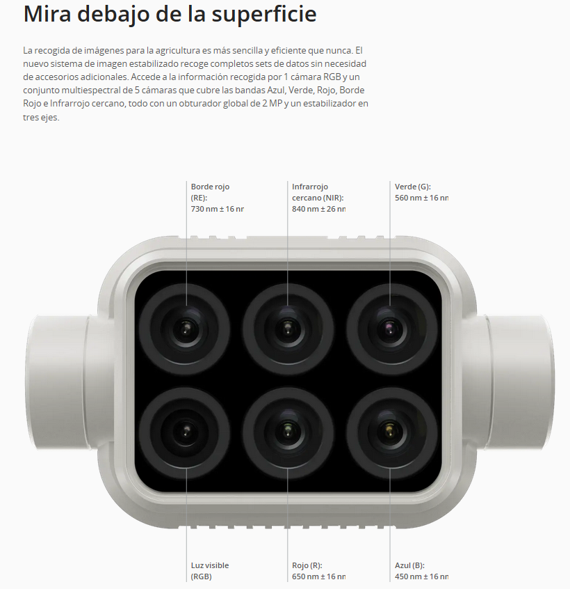
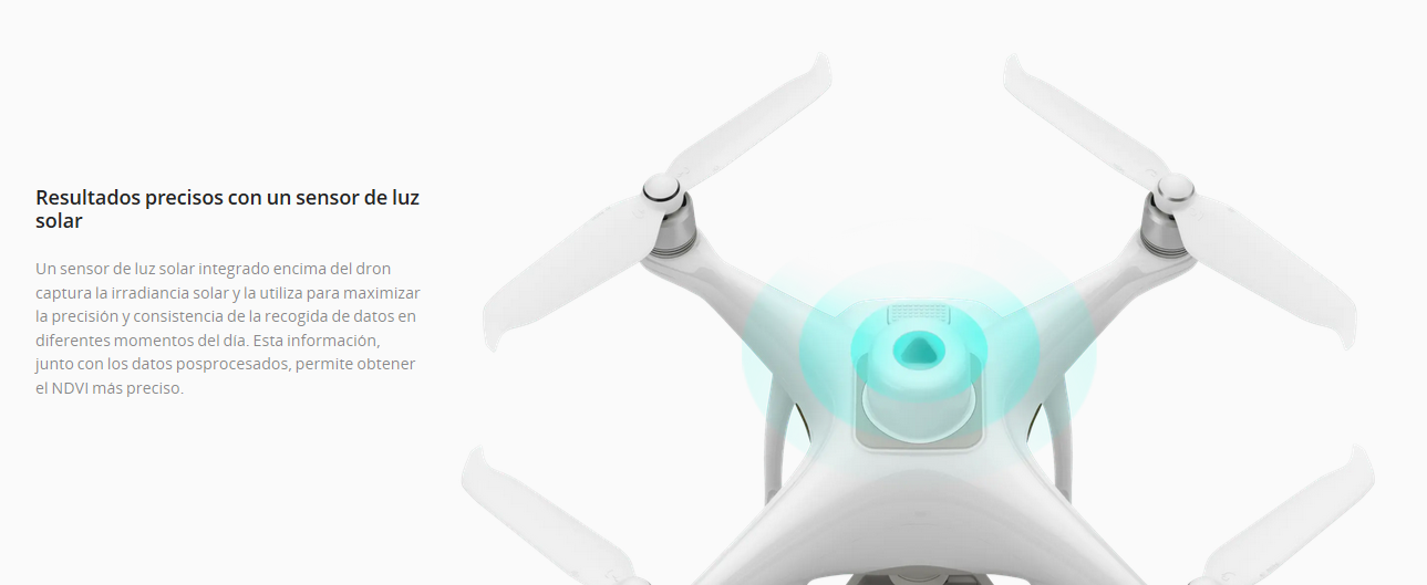
P4 Multispectral features a gimbal-stabilised camera system, this system is comprised of an RGB camera and a multispectral camera array with five narrowband sensors - including red-edge and near-infrared - that are capable of capturing light visible and invisible to the human eye. This data provides trained professionals with unique insights into vegetation stress, soil composition, water salinity and pollution. Thanks to an additional integrated sunlight sensor, the phantom 4 multispectral maximises the accuracy and consistency of data collection during successive missions regardless of the time of day.
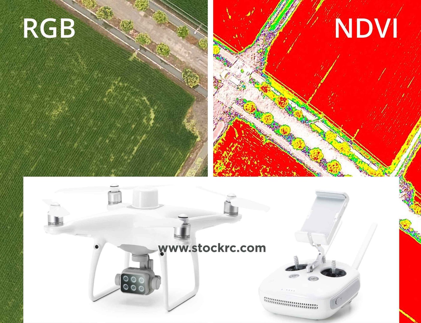
Thanks to the DJI Ground Station Pro flight planning application, pilots can switch between RGB and NDVI video camera views in real time to get an immediate view of the field situation. This model integrates an RTK positioning module and the TimeSync system which provides accurate, real-time positioning data for each image, optimising photogrammetric results and providing accurate centimetre-level measurements.
Industry workflow compatibility
P4 Multispectral is compatible with industry standard workflows, including flight scheduling, mapping and analysis software from DJI and other leading vendors. Using the DJI GS Pro application, users can create automated and repeatable missions, including flight planning, mission execution and flight data management. Collected data can be easily imported into DJI Terra or a suite of third-party software, including Pix4D Mapper and DroneDeploy, for analysis and to generate additional vegetation index maps. In addition, Phantom 4 Multispectral users can enhance RTK positioning accuracy without the need for an internet connection by using DJI's high-precision D-RTK 2 mobile GNSS station, which is compatible with all major satellite navigation systems worldwide, or by using a third-party RTK network via an internet-connected iPad.
Powerful performance
Built on the proven Phantom airframe, the Phantom 4 Multispectral takes advantage of DJI's powerful OcuSync transmission system to deliver a smooth flight experience, with less signal interference, improved video transmission and a maximum transmission range of 7km(FCC). Each of its 2-megapixel cameras features a global shutter for sharp in-flight images, up to 27 minutes per battery.
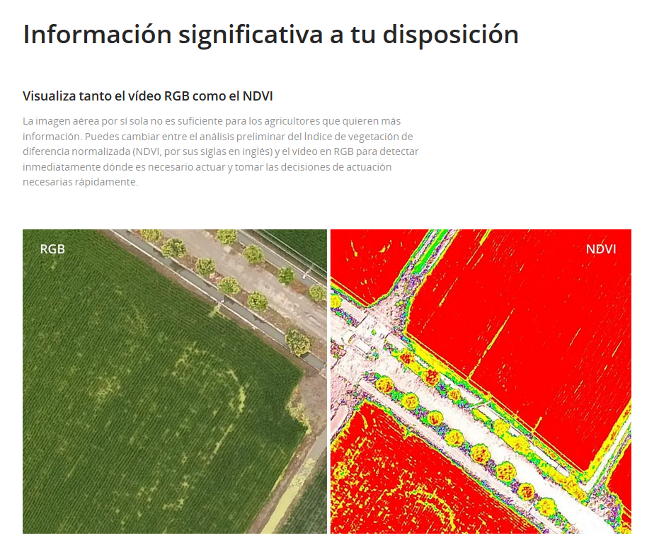
Live RGB and NDVI imaging
DJI P4 Multispectral allows you to switch between NDVI analysis and RGB imaging in real time, making it easy to make decisions as you fly.
Aircraft
-
Takeoff Weight
-
1487 g
-
Diagonal Distance (Propellers Excluded)
-
350 mm
-
Max Service Ceiling Above Sea Level
-
19685 ft (6000 m)
-
Max Ascent Speed
-
6 m/s (automatic flight); 5 m/s (manual control)
-
Max Descent Speed
-
3 m/s
-
Max Speed
-
31 mph (50 kph) (P-mode); 36 mph (58 kph) (A-mode)
-
Max Flight Time
-
Approx. 27 minutes
-
Operating Temperature
-
0° to 40° C (32° to 104° F)
-
Operating Frequency
-
2.4000 GHz to 2.4835 GHz (Europe, Japan, Korea)
5.725 GHz to 5.850 GHz (Other countries/regions)[1]
-
Transmission Power (EIRP)
-
2.4 GHz: < 20 dBm (CE / MIC / KCC)
5.8 GHz: < 26 dBm (FCC / SRRC / NCC)
-
Hover Accuracy Range
-
RTK enabled and functioning properly:
Vertical: ± 0.1 m; Horizontal: ± 0.1 m
RTK disabled:
Vertical: ± 0.1 m (with vision positioning); ± 0.5 m (with GNSS positioning)
Horizontal: ± 0.3 m (with vision positioning); ± 1.5 m (with GNSS positioning)
-
Image Position Compensation
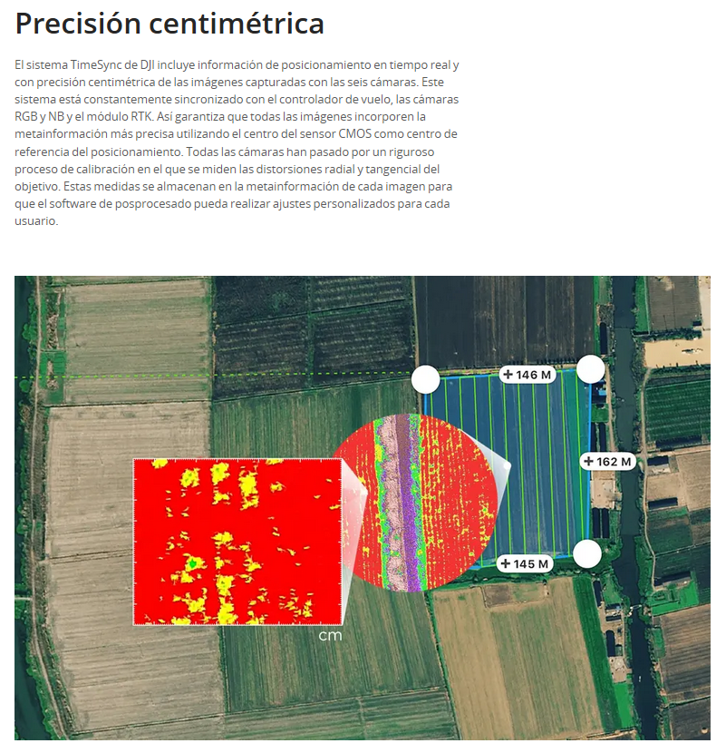
-
The relative positions of the centers of the six cameras’ CMOS and the phase center of the onboard D-RTK antenna have been calibrated and are recorded in the EXIF data of each image.
Mapping Functions
-
Ground Sample Distance (GSD)
-
(H/18.9) cm/pixel, H indicates the aircraft altitude relative to the area mapped (unit: m)
-
Rate of Data Collection
-
Max operating area of approx. 0.63 km2 for a single flight at an altitude of 180 m, i.e., GSD is approx. 9.52 cm/pixel, with a forward overlap rate of 80% and a side overlap ratio of 60%, during a flight that drains the battery from 100% to 30%.
GNSS
-
Single-Frequency High-Sensitivity GNSS
-
GPS + BeiDou + Galileo[2] (Asia); GPS + GLONASS + Galileo[2] (other regions)
-
Multi-Frequency Multi-System High-Precision RTK GNSS
-
Frequency Used
GPS: L1/L2; GLONASS: L1/L2; BeiDou: B1/B2; Galileo[2]: E1/E5
First-Fixed Time: < 50 s
Positioning Accuracy: Vertical 1.5 cm + 1 ppm (RMS); Horizontal 1 cm + 1 ppm (RMS).
1 ppm indicates error with a 1 mm increase over 1 km of movement.
Velocity Accuracy: 0.03 m/s
Gimbal
-
Controllable Range
-
Tilt: -90° to +30°
Vision System
-
Velocity Range
-
≤ 31 mph (50 kph) at 6.6 ft (2 m) above ground with adequate lighting
-
Altitude Range
-
0 - 33 ft (0 - 10 m)
-
Operating Range
-
0 - 33 ft (0 - 10 m)
-
Obstacle Sensory Range
-
2 - 98 ft (0.7 - 30 m)
-
Operating Environment
-
Surfaces with clear patterns and adequate lighting (> 15 lux)
Camera
-
Sensors
-
Six 1/2.9” CMOS, including one RGB sensor for visible light imaging and five monochrome sensors for multispectral imaging.
Each Sensor: Effective pixels 2.08 MP (2.12 MP in total)
-
Filters
-
Blue (B): 450 nm ± 16 nm; Green (G): 560 nm ± 16 nm; Red (R): 650 nm ± 16 nm; Red edge (RE): 730 nm ± 16 nm; Near-infrared (NIR): 840 nm ± 26 nm
-
Lenses
-
FOV (Field of View): 62.7°
Focal Length: 5.74 mm (35 mm format equivalent: 40 mm), autofocus set at ∞
Aperture: f/2.2
-
RGB Sensor ISO Range
-
200 - 800
-
Monochrome Sensor Gain
-
1 - 8x
-
Electronic Global Shutter
-
1/100 - 1/20000 s (visible light imaging); 1/100 - 1/10000 s (multispectral imaging)
-
Max Image Size
-
1600×1300 (4:3.25)
-
Photo Format
-
JPEG (visible light imaging) + TIFF (multispectral imaging)
-
Supported File Systems
-
FAT32 (£ 32 GB); exFAT (> 32 GB)
-
Supported SD Cards
-
microSD with a minimum write speed of 15 MB/s. Max Capacity: 128 GB. Class 10 or UHS-1 rating required
-
Operating Temperature
-
0° to 40° C (32° to 104° F)
Remote Controller
-
Operating Frequency
-
2.4000 GHz to 2.4835 GHz (Europe, Japan, Korea)
5.725 GHz to 5.850 GHz (Other countries/regions)[1]
-
Transmission Power (EIRP)
-
2.4 GHz: < 20 dBm (CE / MIC / KCC)
5.8 GHz: < 26 dBm (FCC / SRRC / NCC)
-
Max Transmission Distance
-
FCC / NCC: 4.3 mi (7 km)
CE / MIC / KCC / SRRC: 3.1 mi (5 km)(Unobstructed, free of interference)
-
Built-in Battery
-
6000 mAh LiPo 2S
-
Operating Current / Voltage
-
1.2 A @ 7.4 V
-
Mobile Device Holder
-
Tablets and smartphones
-
Operating Temperature
-
0° to 40° C (32° to 104° F)
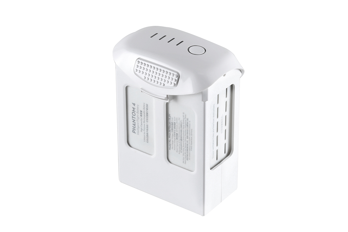
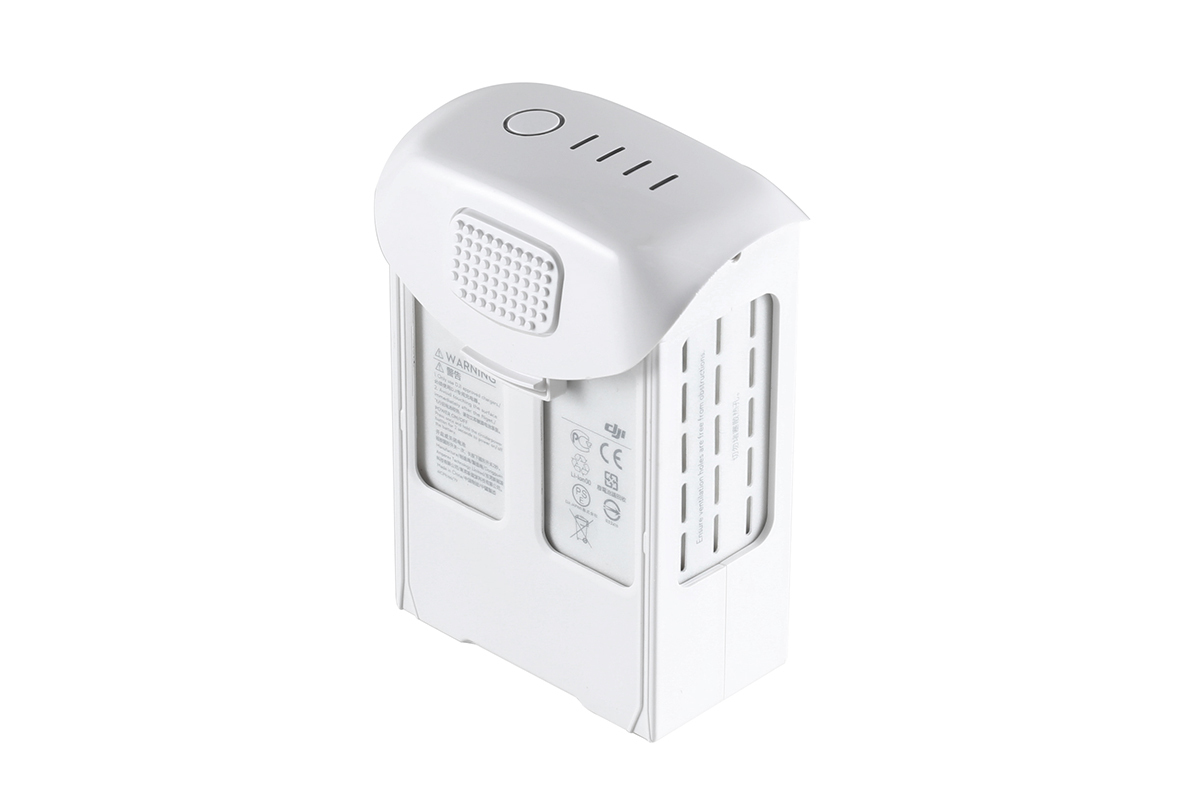
Intelligent Flight Battery (PH4-5870mAh-15.2V)
-
Capacity
-
5870 mAh
-
Voltage
-
15.2 V
-
Battery Type
-
LiPo 4S
-
Energy
-
89.2 Wh
-
Net Weight
-
468 g
-
Operating Temperature
-
-10° to 40° C (14° to 104° F)
-
Charging Temperature
-
5° to 40° C (41° to 104° F)
-
Max Charging Power
-
160 W
Intelligent Flight Battery Charging Hub (PHANTOM 4 CHARGING HUB)
-
Voltage
-
17.5 V
-
Operating Temperature
-
5° to 40° C (41° to 104° F)
AC Power Adapter (PH4C160)
-
Voltage
-
17.4 V
-
Rated Power
-
160 W
NOTE
-
[1] To comply with local laws and regulations, this frequency is not available in some countries or regions.
[2] Support for Galileo is coming soon.

P4 Multispectral
- Drone for precision agriculture and environmental monitoring
- Provides real-time NDVI mapping
- 6 sensors in 1, RGB, Blue, Green, Green, Red, Red Edge and Near Infrared
- Allows quick detection of crop problems.
- 27 min flight time and up to 7km(FCC)/ 5km(CE) range
- High accuracy thanks to RTK technology.
DJI introduces the Phantom 4 Multispectral, aimed at precision agriculture and land management. According to the drone manufacturer, this will be its first drone with an integrated multispectral camera, built with the aim of helping to solve the current problems farmers face in a more efficient way.
DJI Phantom 4 Multispectral
DJI, the undisputed leader in civil drones and aerial imaging technology, is setting a new standard for easy-to-use agricultural drones with the Phantom 4 Multispectral, the company's first drone to already integrate a high-quality multispectral camera and combine it with RTK technology for more accurate data.
Phantom 4 Multispectral combines data from its six individual sensors to provide a representation of crop health, from individual plants to entire fields, as well as weeds, pests and a wide range of soil conditions. With the agricultural drone market expected to grow from $1.2bn in 2019 to $4.8bn by 2024, the P4 Multispectral provides farmers and agronomists with a new tool to improve crop yields, reduce costs and help environmental professionals easily monitor the vegetation on the land they manage.
"Phantom 4 Multispectral has the promise to transform the agriculture and land management industries by collecting accurate plant-level data without having to send staff into the field to conduct manual surveys," said Jan Gasparic, Director of Strategic Partnerships at DJI. "By combining multispectral imaging into one reliable, efficient and affordable tool, DJI is making this transformative technology more accessible to professionals around the world who are pioneering drone adoption in their industries."
Accurate multispectral imaging
P4 Multispectral features a gimbal-stabilised camera system, this system is comprised of an RGB camera and a multispectral camera array with five narrowband sensors - including red-edge and near-infrared - that are capable of capturing light visible and invisible to the human eye. This data provides trained professionals with unique insights into vegetation stress, soil composition, water salinity and pollution. Thanks to an additional integrated sunlight sensor, the phantom 4 multispectral maximises the accuracy and consistency of data collection during successive missions regardless of the time of day.
Thanks to the DJI Ground Station Pro flight planning application, pilots can switch between RGB and NDVI video camera views in real time to get an immediate view of the field situation. This model integrates an RTK positioning module and the TimeSync system which provides accurate, real-time positioning data for each image, optimising photogrammetric results and providing accurate centimetre-level measurements.
Industry workflow compatibility
P4 Multispectral is compatible with industry standard workflows, including flight scheduling, mapping and analysis software from DJI and other leading vendors. Using the DJI GS Pro application, users can create automated and repeatable missions, including flight planning, mission execution and flight data management. Collected data can be easily imported into DJI Terra or a suite of third-party software, including Pix4D Mapper and DroneDeploy, for analysis and to generate additional vegetation index maps. In addition, Phantom 4 Multispectral users can enhance RTK positioning accuracy without the need for an internet connection by using DJI's high-precision D-RTK 2 mobile GNSS station, which is compatible with all major satellite navigation systems worldwide, or by using a third-party RTK network via an internet-connected iPad.
Powerful performance
Built on the proven Phantom airframe, the Phantom 4 Multispectral takes advantage of DJI's powerful OcuSync transmission system to deliver a smooth flight experience, with less signal interference, improved video transmission and a maximum transmission range of 7km(FCC). Each of its 2-megapixel cameras features a global shutter for sharp in-flight images, up to 27 minutes per battery.
Live RGB and NDVI imaging
DJI P4 Multispectral allows you to switch between NDVI analysis and RGB imaging in real time, making it easy to make decisions as you fly.
Aircraft
-
Takeoff Weight
-
1487 g
-
Diagonal Distance (Propellers Excluded)
-
350 mm
-
Max Service Ceiling Above Sea Level
-
19685 ft (6000 m)
-
Max Ascent Speed
-
6 m/s (automatic flight); 5 m/s (manual control)
-
Max Descent Speed
-
3 m/s
-
Max Speed
-
31 mph (50 kph) (P-mode); 36 mph (58 kph) (A-mode)
-
Max Flight Time
-
Approx. 27 minutes
-
Operating Temperature
-
0° to 40° C (32° to 104° F)
-
Operating Frequency
-
2.4000 GHz to 2.4835 GHz (Europe, Japan, Korea)
5.725 GHz to 5.850 GHz (Other countries/regions)[1]
-
Transmission Power (EIRP)
-
2.4 GHz: < 20 dBm (CE / MIC / KCC)
5.8 GHz: < 26 dBm (FCC / SRRC / NCC)
-
Hover Accuracy Range
-
RTK enabled and functioning properly:
Vertical: ± 0.1 m; Horizontal: ± 0.1 m
RTK disabled:
Vertical: ± 0.1 m (with vision positioning); ± 0.5 m (with GNSS positioning)
Horizontal: ± 0.3 m (with vision positioning); ± 1.5 m (with GNSS positioning)
-
Image Position Compensation
-
The relative positions of the centers of the six cameras’ CMOS and the phase center of the onboard D-RTK antenna have been calibrated and are recorded in the EXIF data of each image.
Mapping Functions
-
Ground Sample Distance (GSD)
-
(H/18.9) cm/pixel, H indicates the aircraft altitude relative to the area mapped (unit: m)
-
Rate of Data Collection
-
Max operating area of approx. 0.63 km2 for a single flight at an altitude of 180 m, i.e., GSD is approx. 9.52 cm/pixel, with a forward overlap rate of 80% and a side overlap ratio of 60%, during a flight that drains the battery from 100% to 30%.
GNSS
-
Single-Frequency High-Sensitivity GNSS
-
GPS + BeiDou + Galileo[2] (Asia); GPS + GLONASS + Galileo[2] (other regions)
-
Multi-Frequency Multi-System High-Precision RTK GNSS
-
Frequency Used
GPS: L1/L2; GLONASS: L1/L2; BeiDou: B1/B2; Galileo[2]: E1/E5
First-Fixed Time: < 50 s
Positioning Accuracy: Vertical 1.5 cm + 1 ppm (RMS); Horizontal 1 cm + 1 ppm (RMS).
1 ppm indicates error with a 1 mm increase over 1 km of movement.
Velocity Accuracy: 0.03 m/s
Gimbal
-
Controllable Range
-
Tilt: -90° to +30°
Vision System
-
Velocity Range
-
≤ 31 mph (50 kph) at 6.6 ft (2 m) above ground with adequate lighting
-
Altitude Range
-
0 - 33 ft (0 - 10 m)
-
Operating Range
-
0 - 33 ft (0 - 10 m)
-
Obstacle Sensory Range
-
2 - 98 ft (0.7 - 30 m)
-
Operating Environment
-
Surfaces with clear patterns and adequate lighting (> 15 lux)
Camera
-
Sensors
-
Six 1/2.9” CMOS, including one RGB sensor for visible light imaging and five monochrome sensors for multispectral imaging.
Each Sensor: Effective pixels 2.08 MP (2.12 MP in total)
-
Filters
-
Blue (B): 450 nm ± 16 nm; Green (G): 560 nm ± 16 nm; Red (R): 650 nm ± 16 nm; Red edge (RE): 730 nm ± 16 nm; Near-infrared (NIR): 840 nm ± 26 nm
-
Lenses
-
FOV (Field of View): 62.7°
Focal Length: 5.74 mm (35 mm format equivalent: 40 mm), autofocus set at ∞
Aperture: f/2.2
-
RGB Sensor ISO Range
-
200 - 800
-
Monochrome Sensor Gain
-
1 - 8x
-
Electronic Global Shutter
-
1/100 - 1/20000 s (visible light imaging); 1/100 - 1/10000 s (multispectral imaging)
-
Max Image Size
-
1600×1300 (4:3.25)
-
Photo Format
-
JPEG (visible light imaging) + TIFF (multispectral imaging)
-
Supported File Systems
-
FAT32 (£ 32 GB); exFAT (> 32 GB)
-
Supported SD Cards
-
microSD with a minimum write speed of 15 MB/s. Max Capacity: 128 GB. Class 10 or UHS-1 rating required
-
Operating Temperature
-
0° to 40° C (32° to 104° F)
Remote Controller
-
Operating Frequency
-
2.4000 GHz to 2.4835 GHz (Europe, Japan, Korea)
5.725 GHz to 5.850 GHz (Other countries/regions)[1]
-
Transmission Power (EIRP)
-
2.4 GHz: < 20 dBm (CE / MIC / KCC)
5.8 GHz: < 26 dBm (FCC / SRRC / NCC)
-
Max Transmission Distance
-
FCC / NCC: 4.3 mi (7 km)
CE / MIC / KCC / SRRC: 3.1 mi (5 km)(Unobstructed, free of interference)
-
Built-in Battery
-
6000 mAh LiPo 2S
-
Operating Current / Voltage
-
1.2 A @ 7.4 V
-
Mobile Device Holder
-
Tablets and smartphones
-
Operating Temperature
-
0° to 40° C (32° to 104° F)
Intelligent Flight Battery (PH4-5870mAh-15.2V)
-
Capacity
-
5870 mAh
-
Voltage
-
15.2 V
-
Battery Type
-
LiPo 4S
-
Energy
-
89.2 Wh
-
Net Weight
-
468 g
-
Operating Temperature
-
-10° to 40° C (14° to 104° F)
-
Charging Temperature
-
5° to 40° C (41° to 104° F)
-
Max Charging Power
-
160 W
Intelligent Flight Battery Charging Hub (PHANTOM 4 CHARGING HUB)
-
Voltage
-
17.5 V
-
Operating Temperature
-
5° to 40° C (41° to 104° F)
AC Power Adapter (PH4C160)
-
Voltage
-
17.4 V
-
Rated Power
-
160 W
NOTE
-
[1] To comply with local laws and regulations, this frequency is not available in some countries or regions.
[2] Support for Galileo is coming soon.
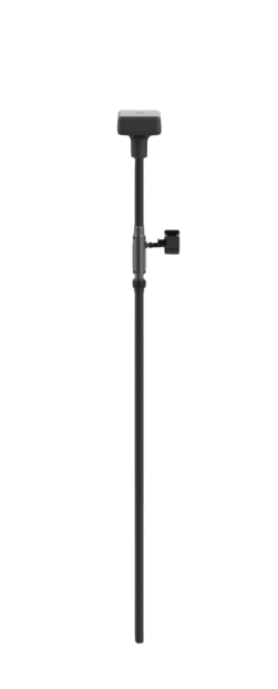
D-RTK High Precision GNSS Mobile Station
In stock
can be shipped within 1 days
Customers who bought this product also bought

Delivery weight: 500 g
|

Delivery weight: 5 kg
|

Delivery weight: 1 kg
|

Delivery weight: 400 g
|

Delivery weight: 200 g
|

Delivery weight: 3 kg
|
Browse these categories as well: Phantom 4 RTK, DJI Matrice 210-200 / V2, Matrice 350 RTK / 300 RTK, P4 Multispectral, DJI Mavic 3 Enterprise, DJI Inspire 3, DJI_Agras_T30, DJI FlyCart 30, DJI_Agras_T10, DJI_Agras_T16, DJI_Agras_T20
HPRC6500W for DJI D-RTK2
Currently unavailable
Notify on availability

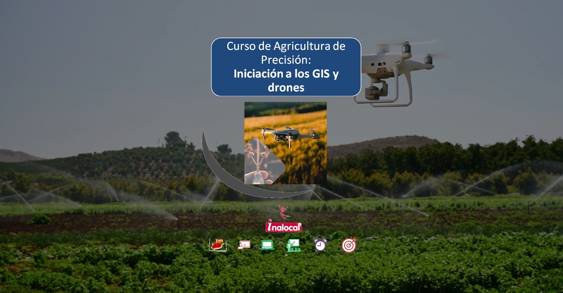
Precision Agriculture Course: Advanced GIS and Drone Management
In stock

Available delivery methods: DSV TNT UPS OTHER EUROPE, BALEARES, ISLAS,CEUTA Y MELILLA, Store Pickup, Free, shipping over 100 euros, Tourline 19H Just Spain & Portugal, DSV TNT UPS EUROPE, Attach to other orders
Precision Agriculture Course: Introduction to GIS and Drones
In stock

Available delivery methods: DSV TNT UPS OTHER EUROPE, BALEARES, ISLAS,CEUTA Y MELILLA, Store Pickup, Free, shipping over 100 euros, Tourline 19H Just Spain & Portugal, DSV TNT UPS EUROPE, Attach to other orders
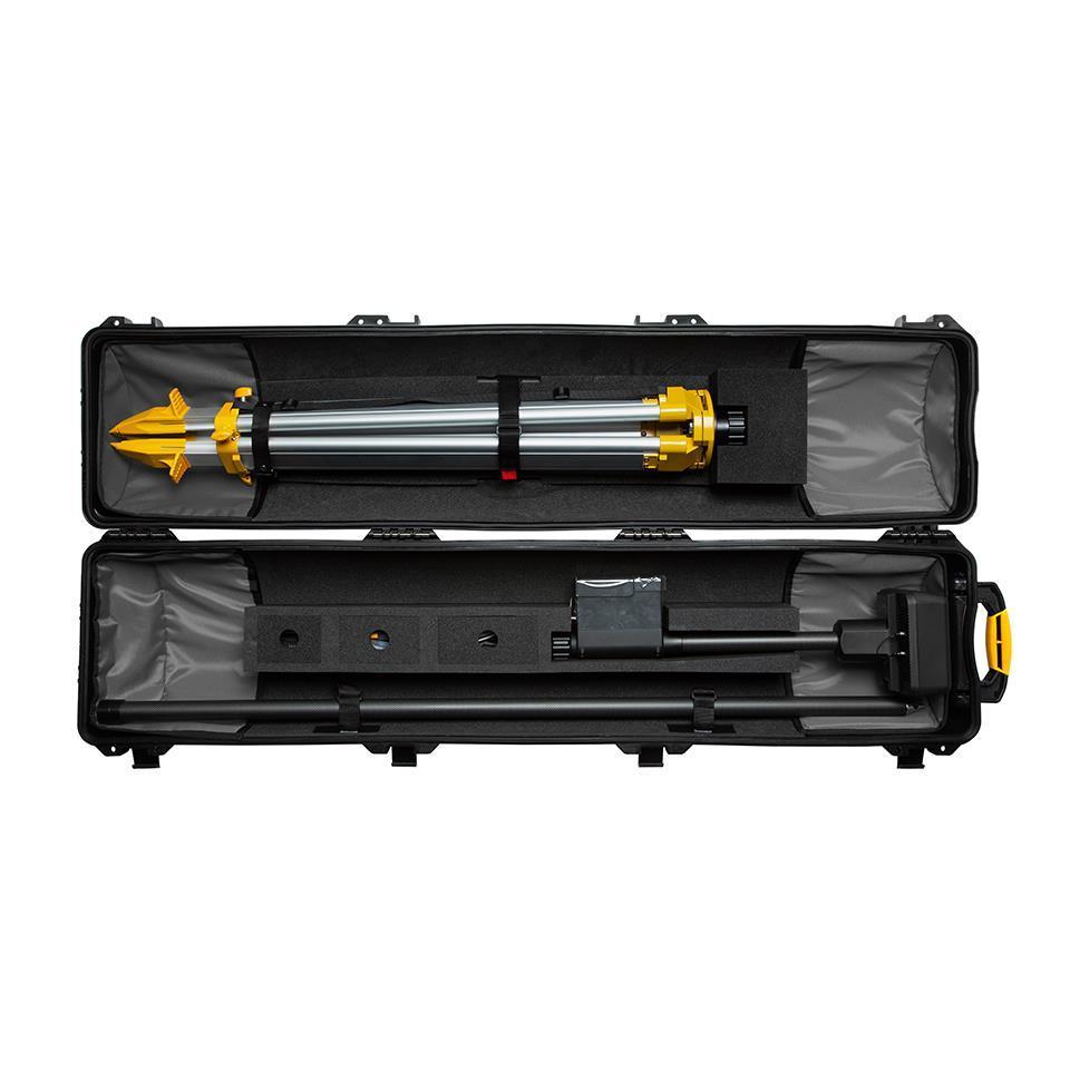
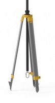
D-RTK 2 base station tripod
In stock
can be shipped within 1 days
Customers who bought this product also bought

Delivery weight: 1 kg
|
Delivery weight: 1 kg
|
Delivery weight: 200 g
|
|
Delivery weight: 5 kg
|
Browse these categories as well: Matrice 350 RTK / 300 RTK, DJI Matrice 210-200 / V2, Phantom 4 RTK, P4 Multispectral, DJI Inspire 3, DJI Mavic 3 Enterprise, DJI FlyCart 30
Phantom 4 Series - Intelligent Flight Battery (High Capacity)
In stock
can be shipped within 1 days
Customers who bought this product also bought

Delivery weight: 100 g
|

Delivery weight: 500 g
|

Delivery weight: 25 kg
|

Delivery weight: 300 g
|
") |

Delivery weight: 300 g
|
|
Delivery weight: 200 g
|

Delivery weight: 200 g
|

Delivery weight: 400 g
|

Delivery weight: 200 g
|
Browse these categories as well: Phantom 4, Phantom 4 RTK, P4 Multispectral
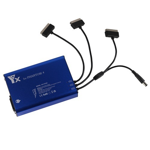
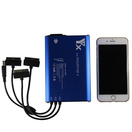
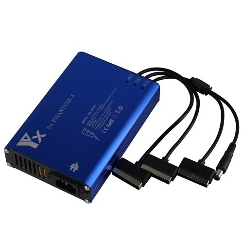
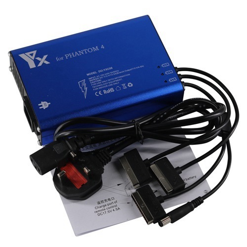
4 in 1 Multi Intelligent Battery Charger for DJI Phantom 4/Pro/Adv
Currently unavailable
Notify on availability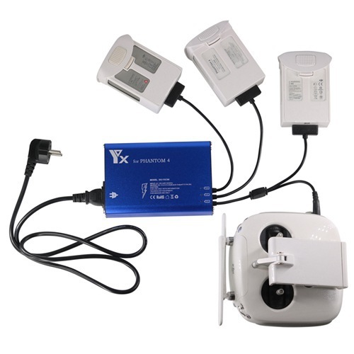
Customers who bought this product also bought
")
Delivery weight: 300 g
|
Delivery weight: 100 g
|
Browse these categories as well: Phantom 4, Phantom 4 RTK, P4 Multispectral
Phantom 4 Part104 Battery charger 160W (Without AC cable)
Currently unavailable
Notify on availability