")
")
")
DJI Store Madrid & Support Center Stockrc

9:00-14:00 and 16:30-19:30
Phone: 0034 91 851 20 96


Now: American Express
![]()
Redsys (Visa/MasterCard/4B/ServiRed)

Paypal
![]()
web optimized for Mobile


DJI Madrid & OFFICIAL Support Center DJI Software DJI Flight Simulator Energy
DJI Madrid & OFFICIAL Support Center DJI Software DJI Terra Pro Overseas Perpetual (1 device)
DJI Madrid & OFFICIAL Support Center DJI Software DJI Terra Electricity Overseas 1 year ( 1 device)
DJI Madrid & OFFICIAL Support Center DJI Software DJI Terra Pro Overseas 1 year (1device)
DJI Madrid & OFFICIAL Support Center DJI Software DJI Flight Simulator Enterprise
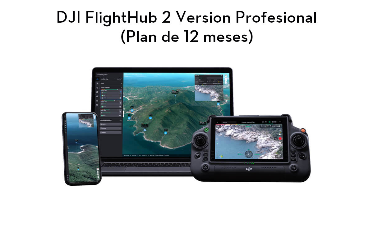
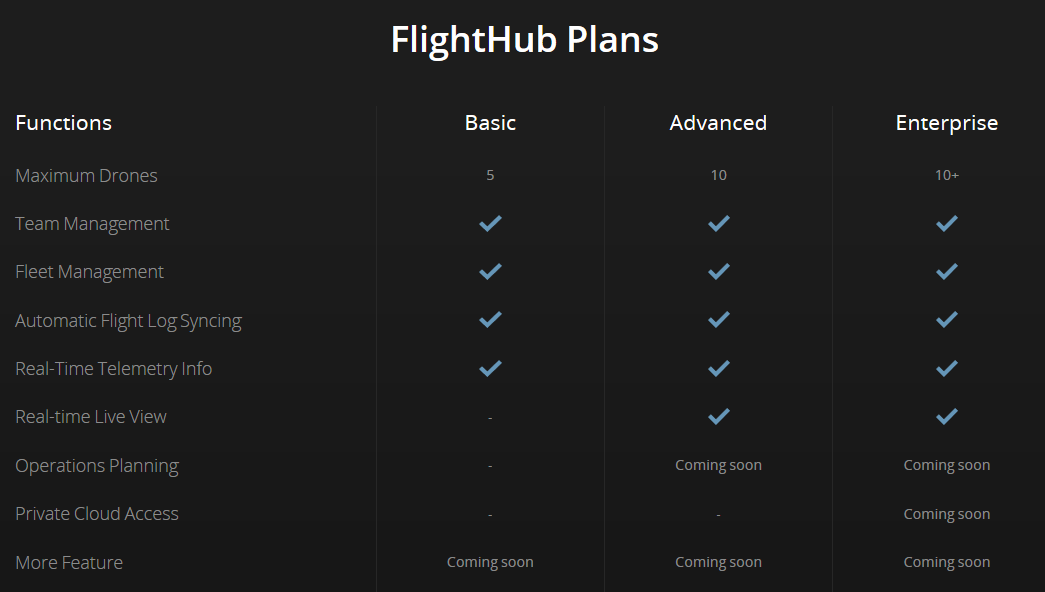
DJI Madrid & OFFICIAL Support Center DJI Software DJI FlightHub 2 Professional Version (12 Month Plan)
DJI Madrid & OFFICIAL Support Center DJI Software DJI FlightHub Basic Annual
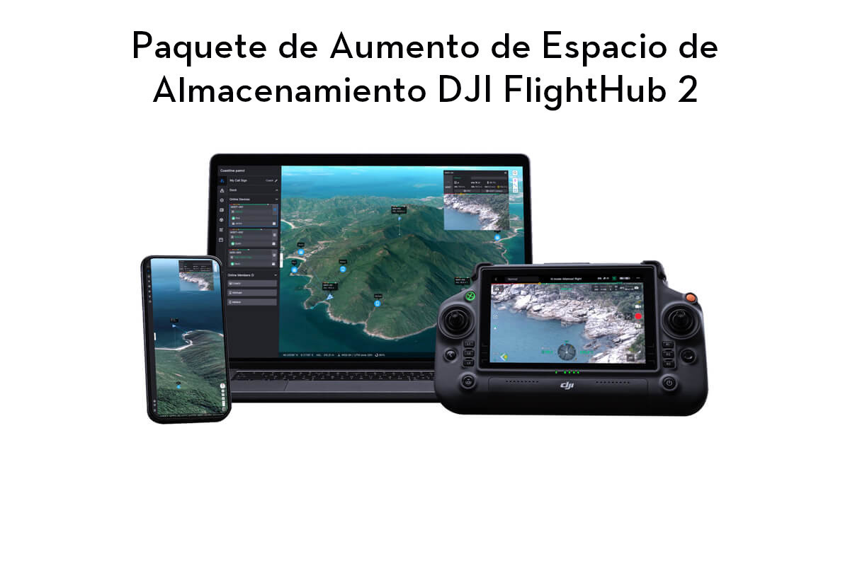
DJI Madrid & OFFICIAL Support Center DJI Software DJI FlightHub 2 Storage Space Enhancer Package
DJI Madrid & OFFICIAL Support Center DJI Software DJI GS Pro License Team Professional (1 Year)
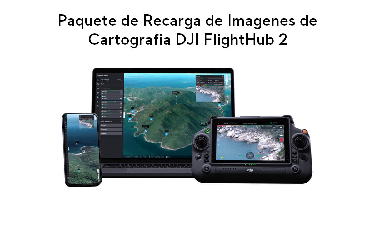
DJI Madrid & OFFICIAL Support Center DJI Software DJI FlightHub 2 Cartography Image Reloading Package
DJI Flight Simulator Energy
Currently unavailable
Notify on availability

DJI Terra Pro Overseas Perpetual (1 device)
In stock
can be shipped within 3 days


DJI Terra Pro Overseas Perpetual (1 device)
To request information, write to shop@stockrc.com
PREORDER 3 DAYS
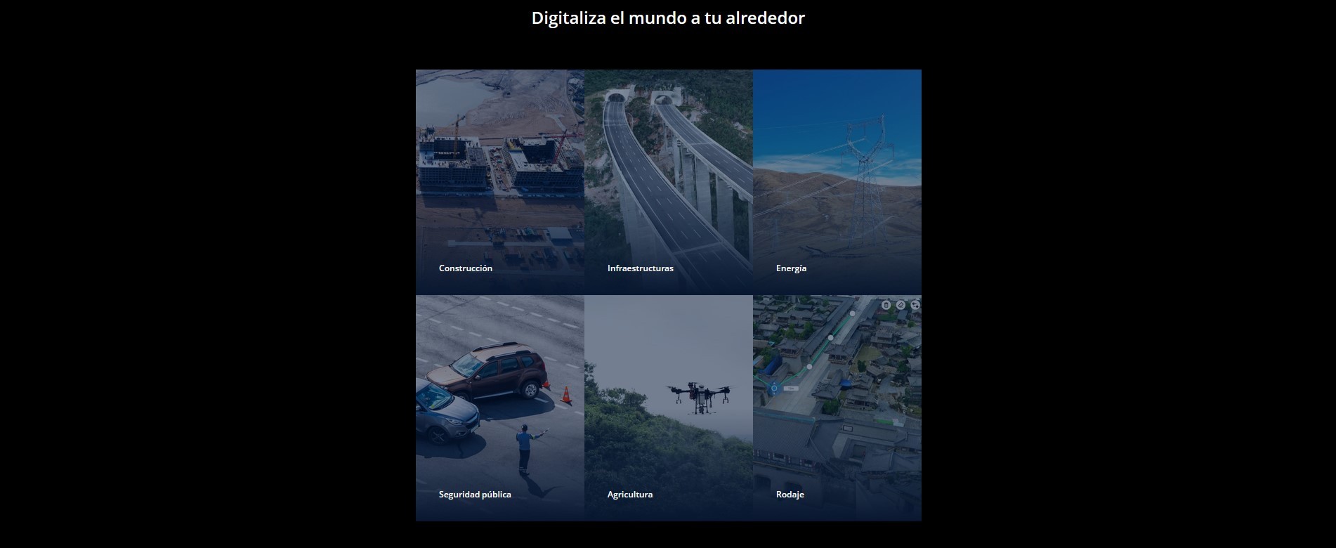
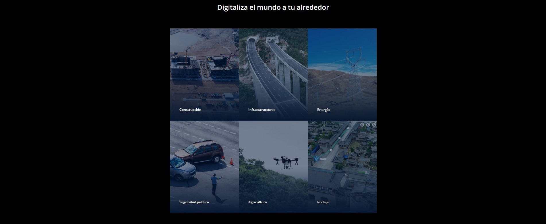
DJI is pleased to introduce the all-new DJI Terra, a software tool that transforms drone data into digital 3D models and maps for easy analysis and decision making. DJI Terra enables businesses and organizations using DJI drone technology to capture, visualize and analyze aerial images for a wide variety of applications across the public safety, construction, infrastructure, agriculture and film industries.
Mas Info : https://goo.gl/XmV3xD
Key Features
Automatic Flight Planning and Data Capture
DJI Terra helps commercial drone pilots quickly plan automated flights with several easy-to-use options based on the area or objects they’d like to capture and the type of map or 3D model they’d like to create. It features three mission planning types:
Area: Capture a specific area quickly and easily by drawing a custom polygonal flight zone on a map. DJI Terra automatically generates efficient flight path options based on the area selected.
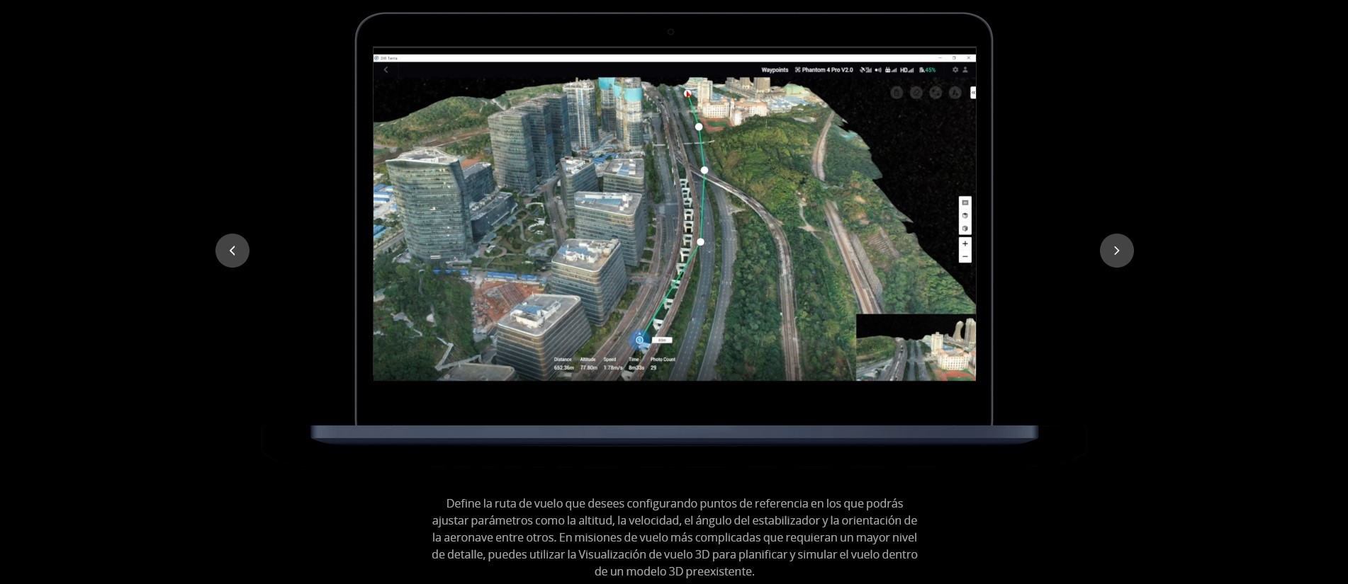
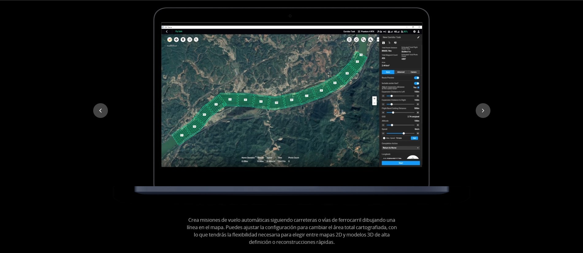
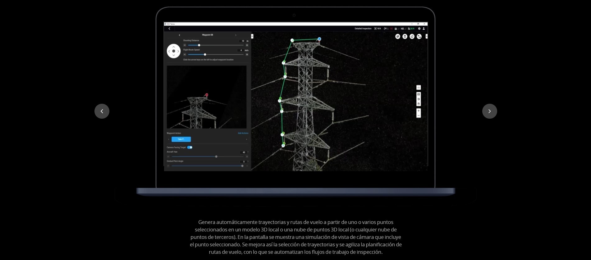
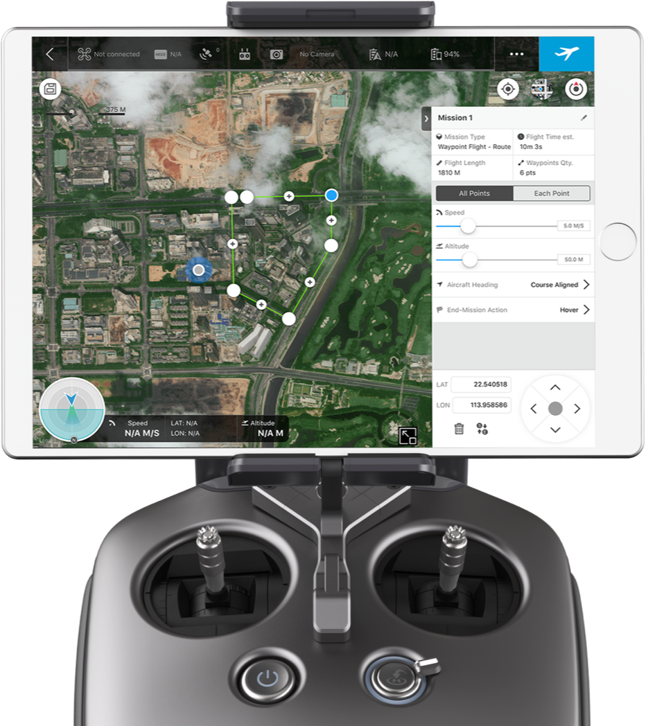
Waypoint: Create dynamic custom flight paths through an area or around objects using waypoints andadjustable parameters like aircraft altitude, speed, heading, gimbal pitch and angle. For more complex missions that require high attention to detail, the 3D Flight Visualization feature enables the design and simulation of missions on existing 3D models.
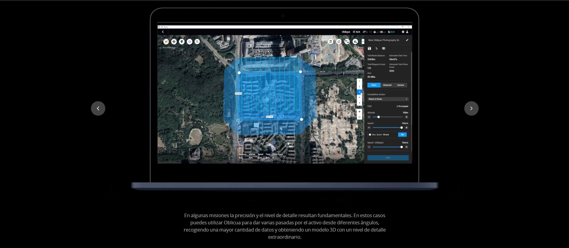
Oblique: Capture a rich data set by automatically flying the same route multiple times. Each flight automatically adjusts the angle of the camera to capture new details, giving an extra crisp 3D model of the object or asset from multiple angles.
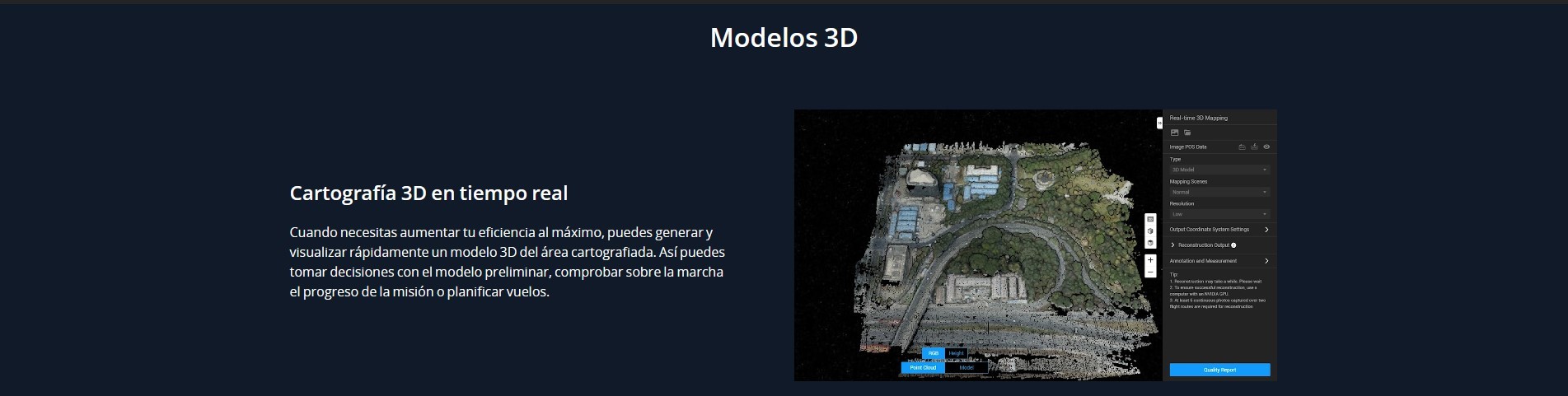
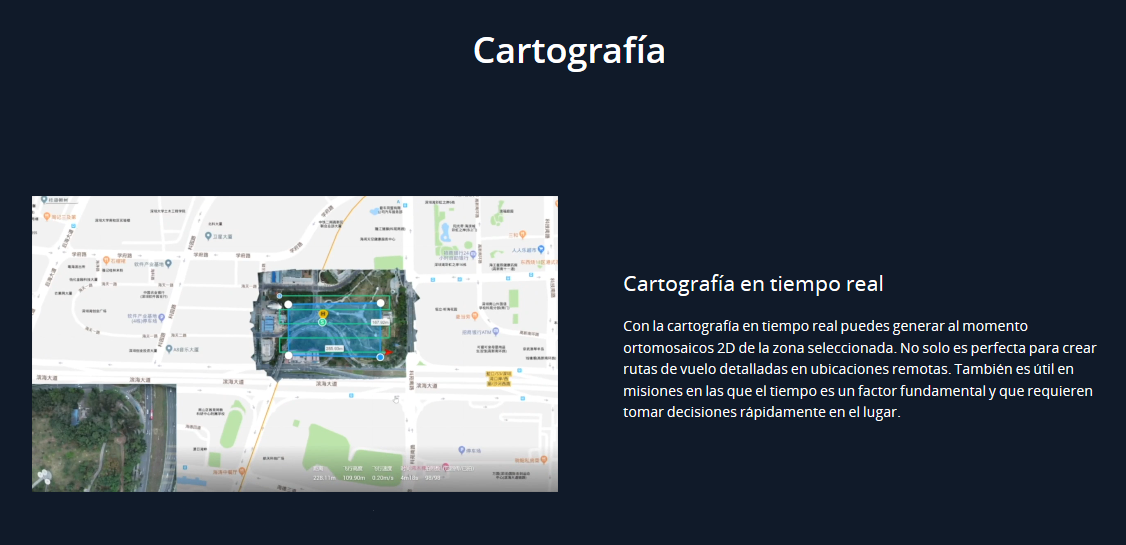
Real-time Mapping and Detailed 3D Models
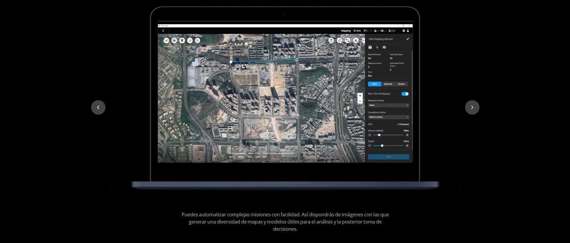
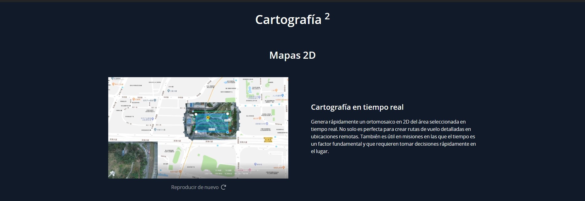
Real-time mapping: DJI Terra allows drone pilots to quickly generate 2D orthomosaic maps as the drone flies, ideal for time-sensitive missions where situational awareness is critical and decisions need to be made in minutes.
Fast processing capability for efficient reconstruction: With DJI Terra, users can efficiently generate realistic representations of any environment through detailed 2D orthomosaics and 3D model reconstructions, used for industrial applications like reconstructing vehicle crashes, tracking progress on construction projects or conducting large-scale critical infrastructure inspections on bridges and roadways.
Easy Data Analysis
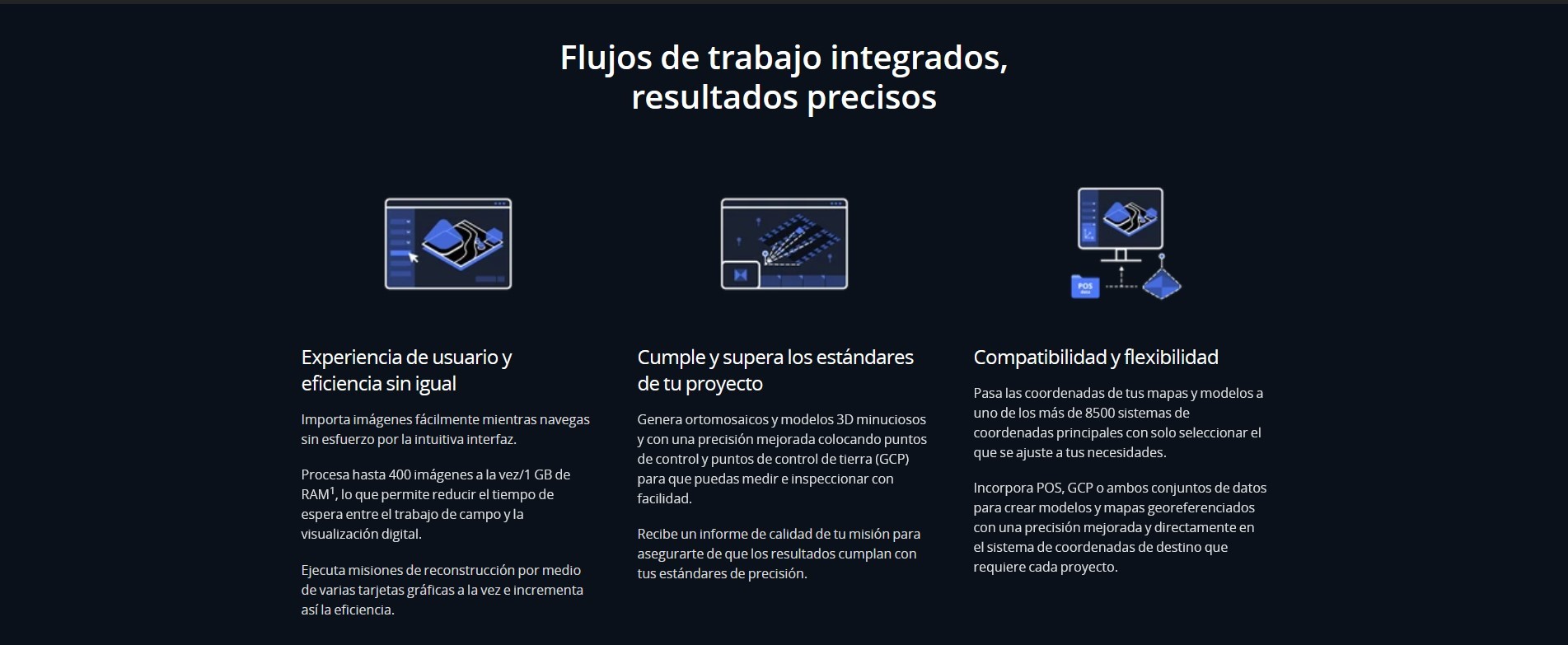
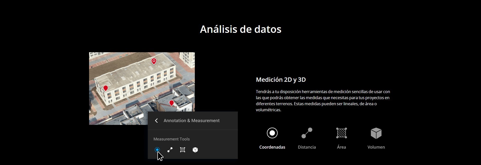
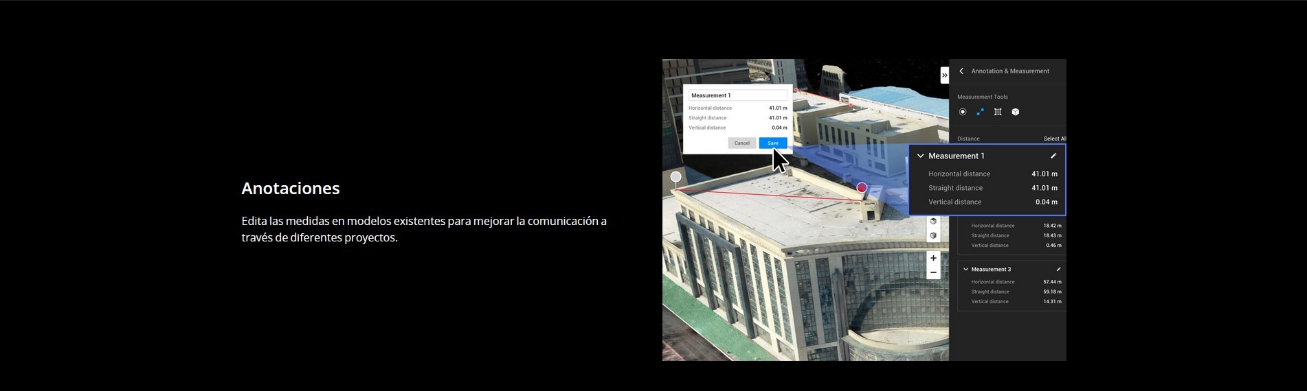
2D and 3D Measurement Tools: analyze data and generate instant insights with easy-to-use analysis tools that provide a variety of measurements including linear distance, surface area and volumetric estimations.
Annotation: To improve team communication and reporting throughout ongoing projects, annotation labels can be edited and shared.
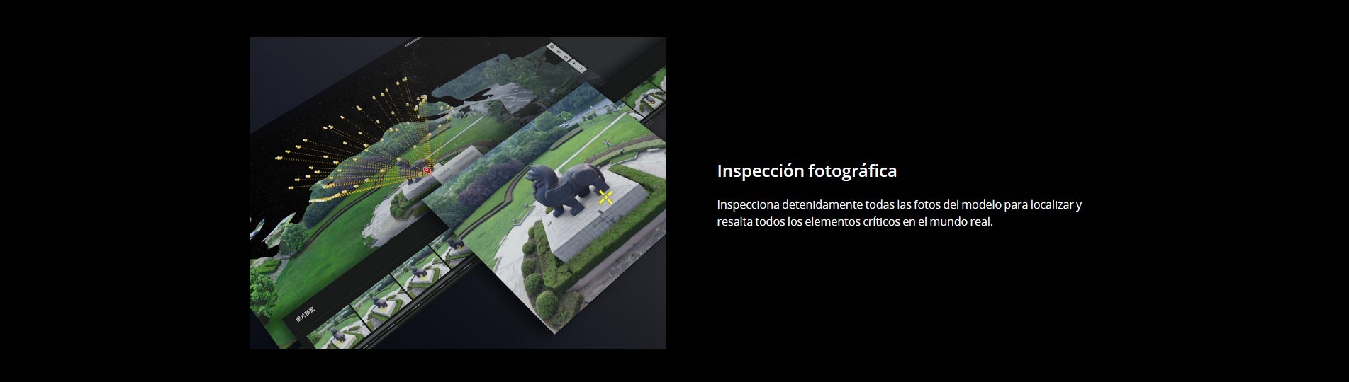
Photo Inspection: Ideal for detailed site inspections and accident reconstruction situations, DJI Terra’s photo inspection tool lets users closely examine every photo used to create the model so they can pinpoint and highlight critical elements.
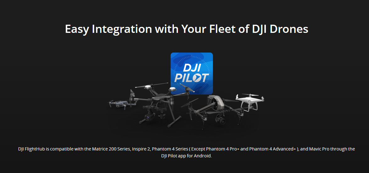
Aircraft Compatibility
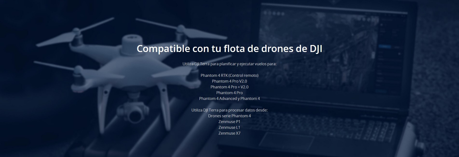
DJI Terra is compatible with the following Phantom 4 Series drones: Phantom 4 RTK, Phantom 4 Pro V2.0, Phantom 4 Pro + V2.0, Phantom 4 Pro, Phantom 4 Advanced and Phantom 4


DJI Terra Electricity Overseas 1 year ( 1 device)
In stock
can be shipped within 3 days


DJI Terra Electricity Overseas 1 year ( 1 device)
PREORDER 3 DAYS
To request information, write to shop@stockrc.com
DJI is pleased to introduce the all-new DJI Terra, a software tool that transforms drone data into digital 3D models and maps for easy analysis and decision making. DJI Terra enables businesses and organizations using DJI drone technology to capture, visualize and analyze aerial images for a wide variety of applications across the public safety, construction, infrastructure, agriculture and film industries.
Mas Info : https://goo.gl/XmV3xD
Key Features
Automatic Flight Planning and Data Capture
DJI Terra helps commercial drone pilots quickly plan automated flights with several easy-to-use options based on the area or objects they’d like to capture and the type of map or 3D model they’d like to create. It features three mission planning types:
Area: Capture a specific area quickly and easily by drawing a custom polygonal flight zone on a map. DJI Terra automatically generates efficient flight path options based on the area selected.
Waypoint: Create dynamic custom flight paths through an area or around objects using waypoints andadjustable parameters like aircraft altitude, speed, heading, gimbal pitch and angle. For more complex missions that require high attention to detail, the 3D Flight Visualization feature enables the design and simulation of missions on existing 3D models.
Oblique: Capture a rich data set by automatically flying the same route multiple times. Each flight automatically adjusts the angle of the camera to capture new details, giving an extra crisp 3D model of the object or asset from multiple angles.
Real-time Mapping and Detailed 3D Models
Real-time mapping: DJI Terra allows drone pilots to quickly generate 2D orthomosaic maps as the drone flies, ideal for time-sensitive missions where situational awareness is critical and decisions need to be made in minutes.
Fast processing capability for efficient reconstruction: With DJI Terra, users can efficiently generate realistic representations of any environment through detailed 2D orthomosaics and 3D model reconstructions, used for industrial applications like reconstructing vehicle crashes, tracking progress on construction projects or conducting large-scale critical infrastructure inspections on bridges and roadways.
Easy Data Analysis
2D and 3D Measurement Tools: analyze data and generate instant insights with easy-to-use analysis tools that provide a variety of measurements including linear distance, surface area and volumetric estimations.
Annotation: To improve team communication and reporting throughout ongoing projects, annotation labels can be edited and shared.
Photo Inspection: Ideal for detailed site inspections and accident reconstruction situations, DJI Terra’s photo inspection tool lets users closely examine every photo used to create the model so they can pinpoint and highlight critical elements.
Aircraft Compatibility
DJI Terra is compatible with the following Phantom 4 Series drones: Phantom 4 RTK, Phantom 4 Pro V2.0, Phantom 4 Pro + V2.0, Phantom 4 Pro, Phantom 4 Advanced and Phantom 4
DJI Terra Pro Overseas 1 year (1device)
In stock
can be shipped within 3 days

DJI Terra Pro Overseas 1 year (1 device)
To request information, write to shop@stockrc.com
PREORDER 3 DAYS
DJI is pleased to introduce the all-new DJI Terra, a software tool that transforms drone data into digital 3D models and maps for easy analysis and decision making. DJI Terra enables businesses and organizations using DJI drone technology to capture, visualize and analyze aerial images for a wide variety of applications across the public safety, construction, infrastructure, agriculture and film industries.
Mas Info : https://goo.gl/XmV3xD
Key Features
Automatic Flight Planning and Data Capture
DJI Terra helps commercial drone pilots quickly plan automated flights with several easy-to-use options based on the area or objects they’d like to capture and the type of map or 3D model they’d like to create. It features three mission planning types:
Area: Capture a specific area quickly and easily by drawing a custom polygonal flight zone on a map. DJI Terra automatically generates efficient flight path options based on the area selected.
Waypoint: Create dynamic custom flight paths through an area or around objects using waypoints andadjustable parameters like aircraft altitude, speed, heading, gimbal pitch and angle. For more complex missions that require high attention to detail, the 3D Flight Visualization feature enables the design and simulation of missions on existing 3D models.
Oblique: Capture a rich data set by automatically flying the same route multiple times. Each flight automatically adjusts the angle of the camera to capture new details, giving an extra crisp 3D model of the object or asset from multiple angles.
Real-time Mapping and Detailed 3D Models
Real-time mapping: DJI Terra allows drone pilots to quickly generate 2D orthomosaic maps as the drone flies, ideal for time-sensitive missions where situational awareness is critical and decisions need to be made in minutes.
Fast processing capability for efficient reconstruction: With DJI Terra, users can efficiently generate realistic representations of any environment through detailed 2D orthomosaics and 3D model reconstructions, used for industrial applications like reconstructing vehicle crashes, tracking progress on construction projects or conducting large-scale critical infrastructure inspections on bridges and roadways.
Easy Data Analysis
2D and 3D Measurement Tools: analyze data and generate instant insights with easy-to-use analysis tools that provide a variety of measurements including linear distance, surface area and volumetric estimations.
Annotation: To improve team communication and reporting throughout ongoing projects, annotation labels can be edited and shared.
Photo Inspection: Ideal for detailed site inspections and accident reconstruction situations, DJI Terra’s photo inspection tool lets users closely examine every photo used to create the model so they can pinpoint and highlight critical elements.
Aircraft Compatibility
DJI Terra is compatible with the following Phantom 4 Series drones: Phantom 4 RTK, Phantom 4 Pro V2.0, Phantom 4 Pro + V2.0, Phantom 4 Pro, Phantom 4 Advanced and Phantom 4
DJI Flight Simulator Enterprise
Currently unavailable
Notify on availability
DJI Flight Simulator Enterprise
The DJI Flight Simulator is compatible with the DJI remote controls for the Phantom 4, Phantom 4 Advanced, Phantom 4 Pro, Phantom 4 Pro V2.0, Lightbridge 2, M600 Pro and Mavic Air. Soon it will be compatible with the Mavic 2 series remote controls.
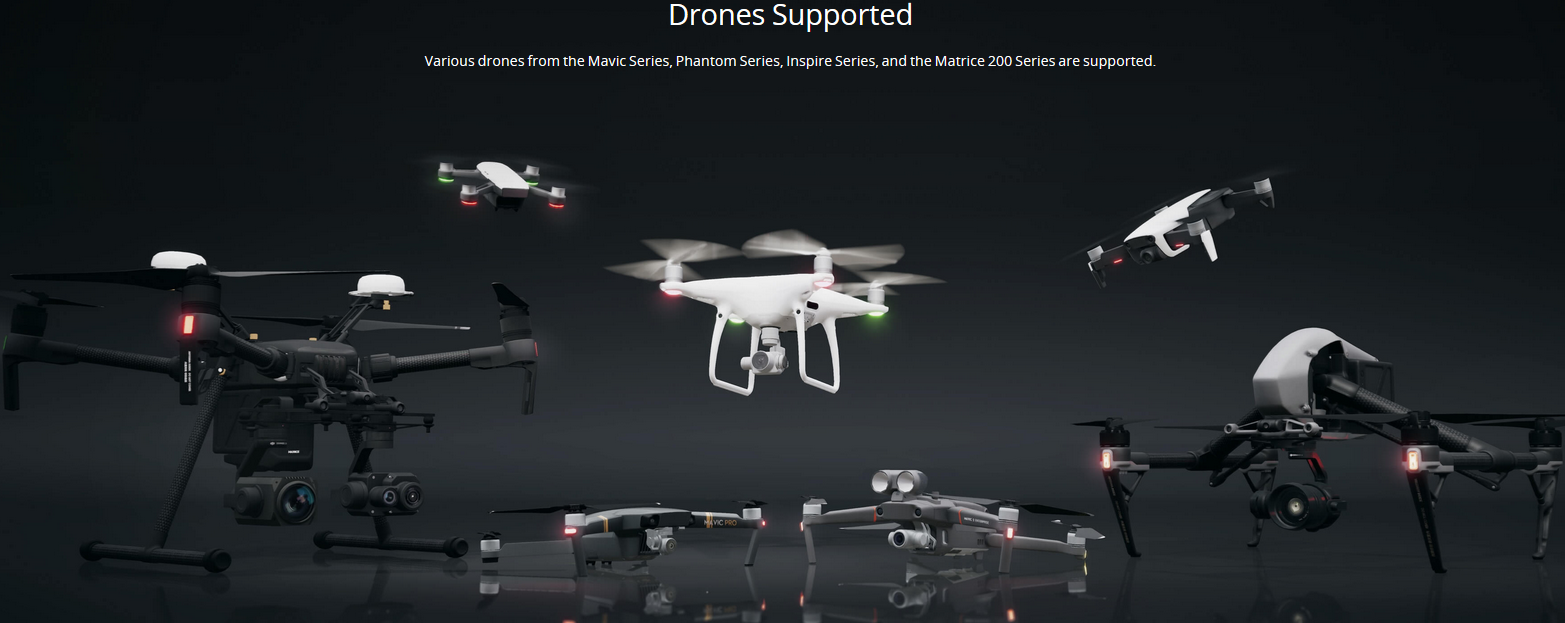
The drones that can be flown in DJI Flight Simulator are:
Mavic Series: Mavic 2 Enterprise, Mavic 2 Zoom, Mavic Air, Mavic 2 Pro.
Spark
Phantom 4 Pro
Inspire Series: Inspire 2, Inspire 1 Pro.
Matrice 200 Series: M210 RTK

DJI FlightHub 2 Professional Version (12 Month Plan)
In stock
can be shipped within 5 days
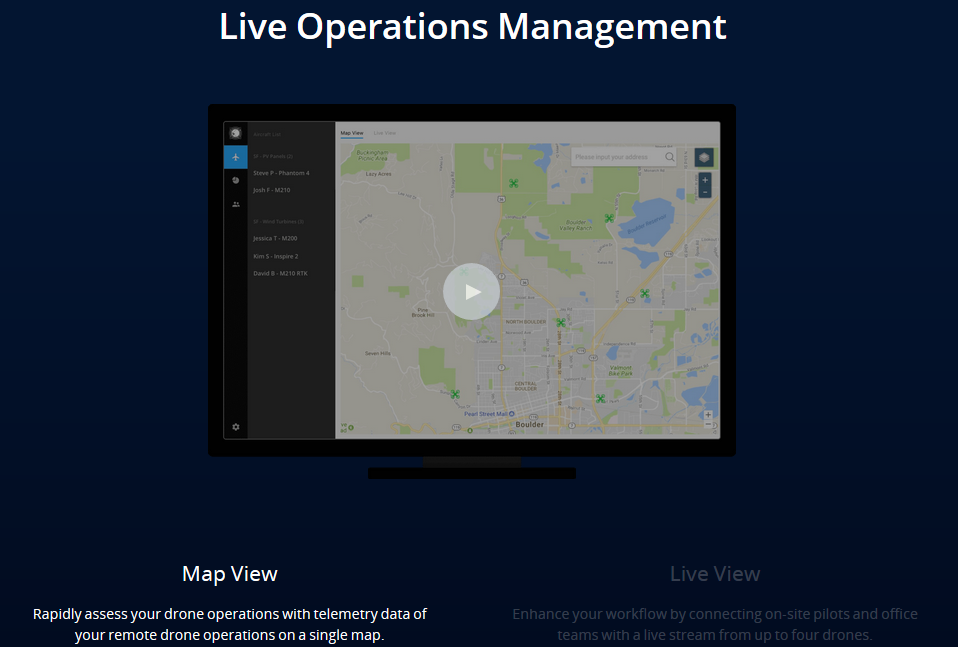
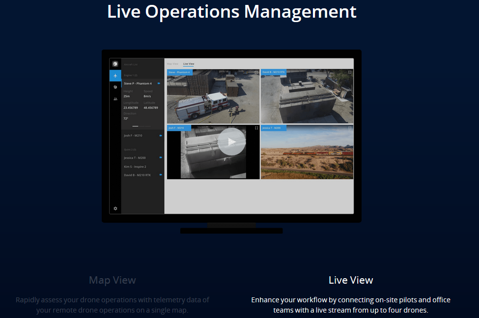
DJI FlightHub Basic Annual
Currently unavailable
Notify on availability


DJI FlightHub Basic Annual
PREORDER 5 DAYS
ANNUAL LICENSE


DJI FlightHub 2 Storage Space Enhancer Package
In stock
can be shipped within 5 days
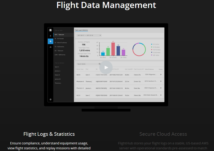
DJI GS Pro License Team Professional (1 Year)
In stock
can be shipped within 3 days


DJI FlightHub 2 Cartography Image Reloading Package
In stock
can be shipped within 5 days