
UgCS Mission Planning Software

UgCS Mission Planning Software
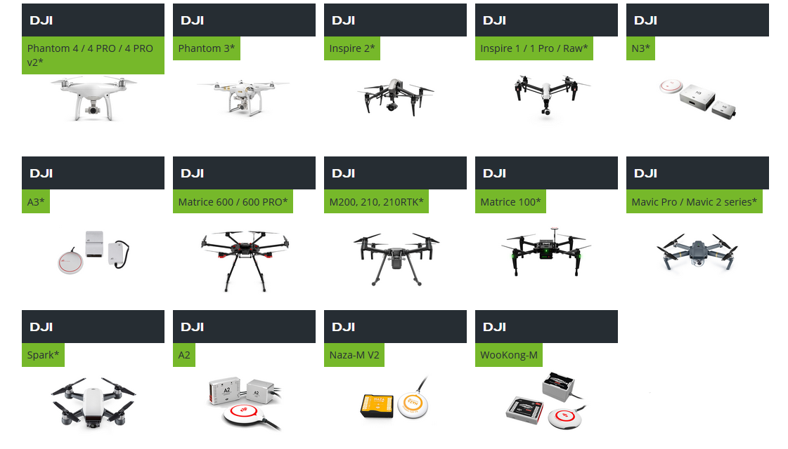
Compatible equipment:
- Phantom 4 / Advance / Pro / V2
- Phantom 3 Series
- Phantom 2
- Inspire 2
- Inspire 1 Series
- Mavic Series 2
- Mavic Pro Series
- Spark
- A3
- N3
- Matrice 600 Series
- Matrice 200 Series
- Matrice 100
- A2
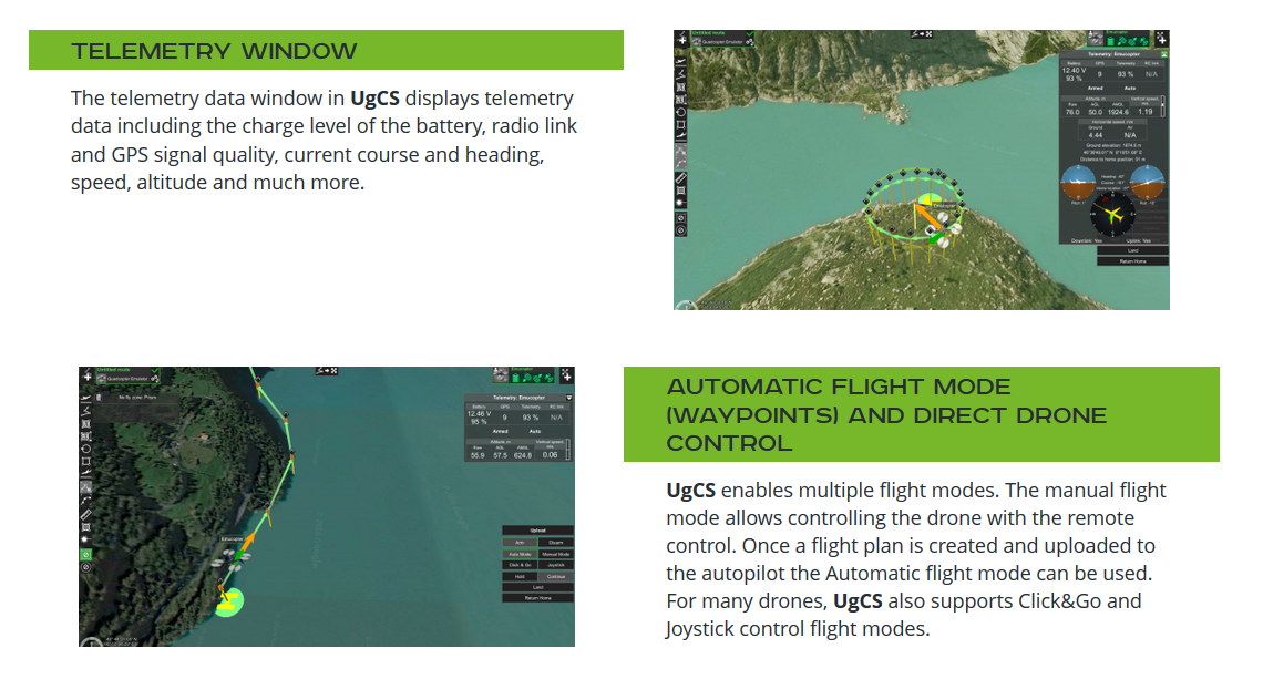
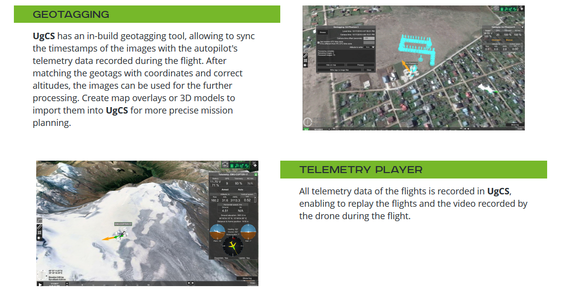
UgCS Pro:
- Fly zone limits for routes
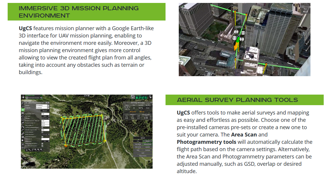
- Immersive 3D mission planning environment
- Waypoints, Linear, Circle, Perimeter, Area Scan tool
- Photogrammetry tool
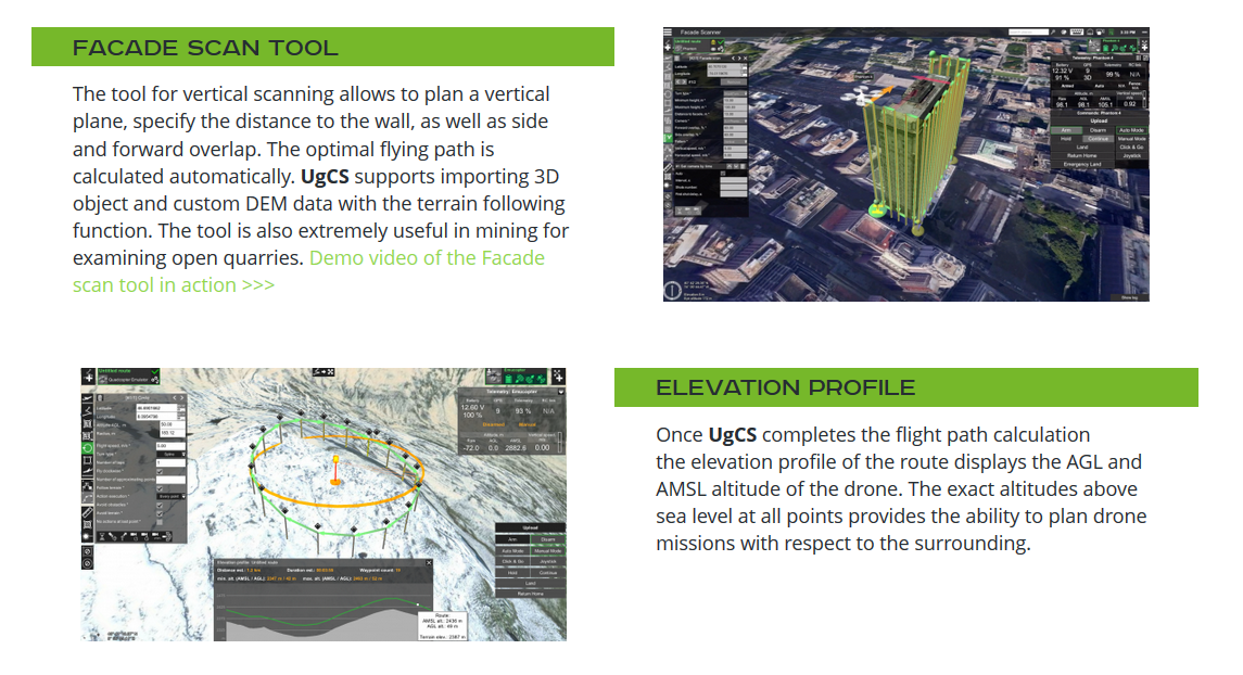
- Facade scan tool
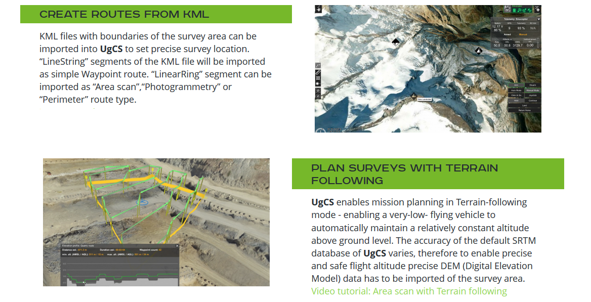
- KML/CSV data import
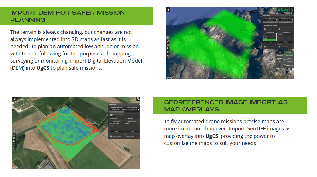
- DEM data import
- Geo-referenced images import
- Elevation profile
- Terrain following
- Software emulator
- Battery change during long routes
- Geotagging
- Telemetry player
- UgCS Mapper
- Video recording
- Camera footprint
- Video streaming from UgCS for DJI to UgCS desktop experimental
- No-Fly zones - airport registry
- Create custom NFZ
- ADS-B Transponder
- Multinode installation
- SDK support limited
- Multi-drone support
- First year's support and update package
- Annual Support & Update package (starting second year)
- E-mail support support@ugcs.com
- Support 24x7


- 1
- 2
Classic view
*
The price includes VAT