")
")
")
DJI Store Madrid & Support Center Stockrc

9:00-14:00 and 16:30-19:30
Phone: 0034 91 851 20 96


Now: American Express
![]()
Redsys (Visa/MasterCard/4B/ServiRed)

Paypal
![]()
web optimized for Mobile


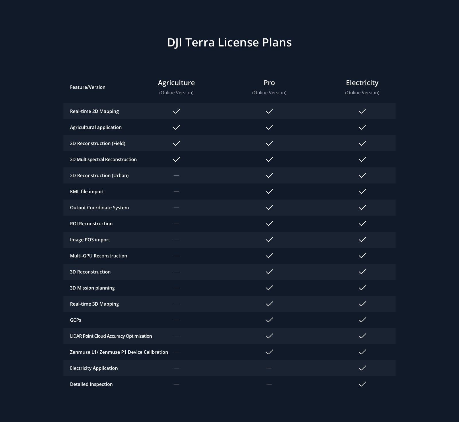
DJI Madrid & OFFICIAL Support Center DJI Software DJI Terra Agricultura 1 Año (3 Dispositivos)
DJI Terra Agricultura 1 Año (3 Dispositivos)
In stock
can be shipped within 3 days
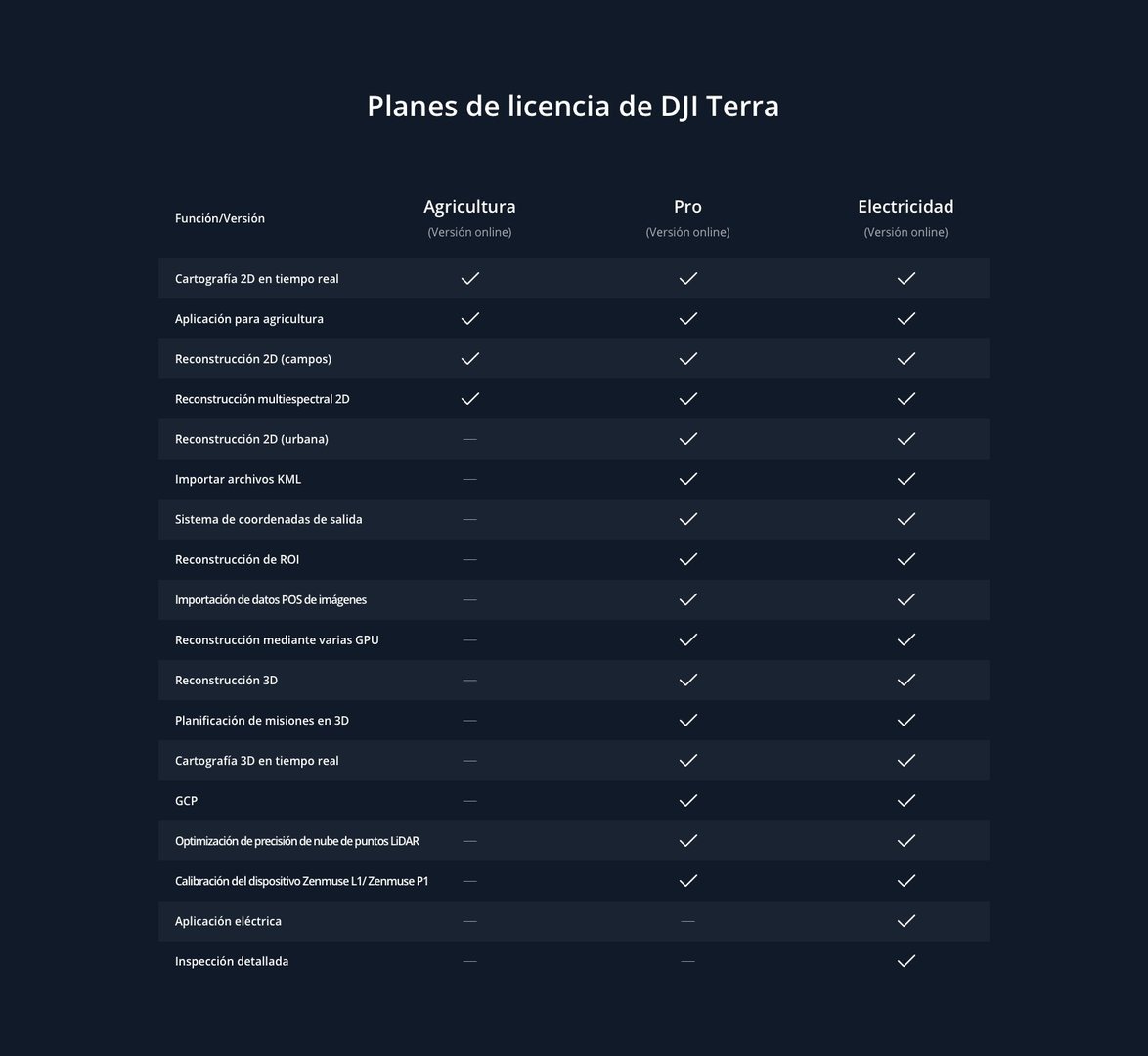

DJI Terra Agrioculture 1 Year (3 Devices)
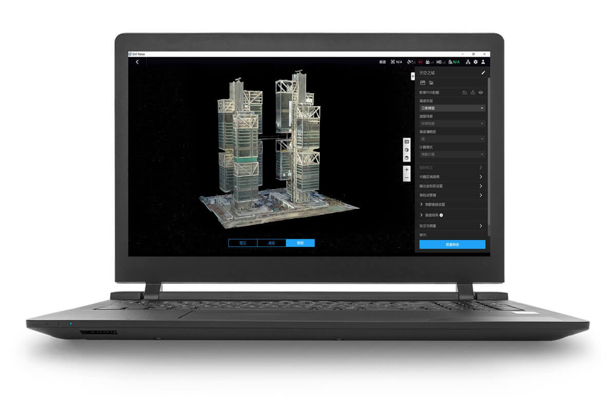
Capture, analyze and visualize your environment with DJI Terra, an easy-to-use mapping software [1] developed to help industry professionals transform real-world scenarios into digital assets.
- Model reconstruction [2]: Import images to generate a high-resolution 2D orthophoto map and a high-accuracy 3D model.
- Real-time reconstruction [3]: Generate a 2D orthophoto map and a 3D model in real time during flight to produce in-flight results.
- LiDAR data processing: Working with DJI L1, DJI Terra can generate high-precision, true-color point clouds with a single click.
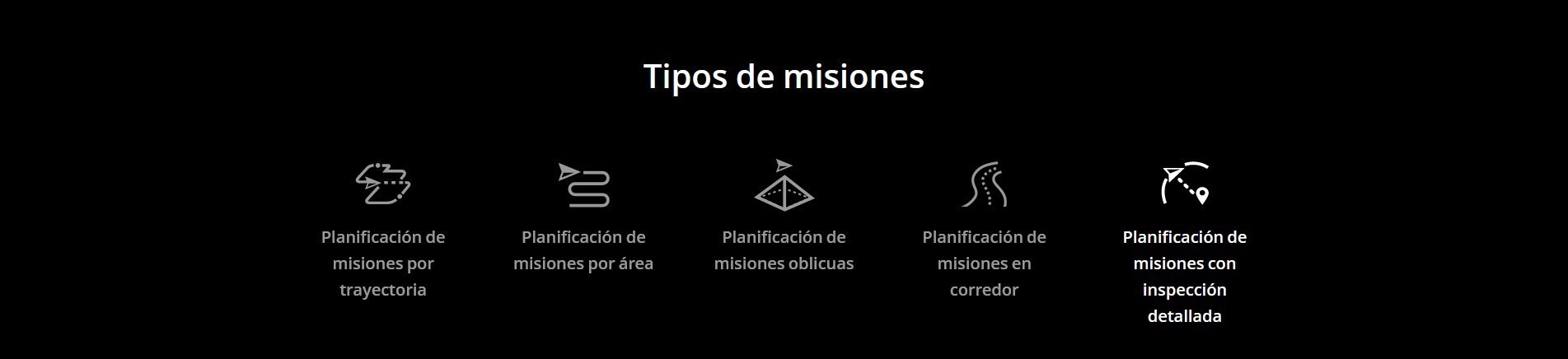
- Detailed inspection [4]: Automatically generates routes based on target points marked in a 3D model or point cloud to automate inspection workflows.
- Model application: Easily measure coordinates, distances, areas, volumes and other key target data and rename or export data results.
[1] Windows 7 or higher (64-bit) system is required to run the software.
[2] Minimum computer configuration requirements: 16 GB memory, NVIDIA graphics card with 3.0 or higher processing power (4 GB graphics memory).
[3] Only Phantom 4 series is supported and the configuration requirements listed in [2] also apply to real-time 3D reconstruction.
[4] Only mission path export to Matrice 300 RTK or Phantom 4 RTK (NO MONITOR RC) is supported.