")
")
")
DJI Store Madrid & Support Center Stockrc

9:00-14:00 and 16:30-19:30
Phone: 0034 91 851 20 96


Now: American Express
![]()
Redsys (Visa/MasterCard/4B/ServiRed)

Paypal
![]()
web optimized for Mobile


Tracking


FacebooK

DJI Madrid & OFFICIAL Support Center UgCS__Sistemas_integrados Laser Falcon methane detector
DJI Madrid & OFFICIAL Support Center UgCS__Sistemas_integrados MagNIMBUS atomic total-field magnetometer
DJI Madrid & OFFICIAL Support Center UgCS__Sistemas_integrados Sistema GPR: Sistemas de radar Zond Aero LF (baja frecuencia)
DJI Madrid & OFFICIAL Support Center UgCS__Sistemas_integrados Sistema GPR: Sistemas de radar Zond Aero 1000 "NG"
DJI Madrid & OFFICIAL Support Center UgCS__Sistemas_integrados GPR system: Radar Systems Zond Aero 500
DJI Madrid & OFFICIAL Support Center UgCS__Sistemas_integrados SENSYS MagDrone R3 magnetometer
DJI Madrid & OFFICIAL Support Center UgCS__Sistemas_integrados Water sampler bundle
DJI Madrid & OFFICIAL Support Center UgCS__Sistemas_integrados Ecosonda EchoLogger ECT D052S
DJI Madrid & OFFICIAL Support Center UgCS__Sistemas_integrados True Terrain Following kit for DJI drones
DJI Madrid & OFFICIAL Support Center UgCS__Sistemas_integrados EchoLogger ECT 400S echo sounder
Laser Falcon methane detector
Currently unavailable
Notify on availability


24,805.00 €
The price includes VAT
Delivery weight: 1 kg
MagNIMBUS atomic total-field magnetometer
Currently unavailable
Notify on availability


22,869.00 €
The price includes VAT
Delivery weight: 5 kg
Sistema GPR: Sistemas de radar Zond Aero LF (baja frecuencia)
Currently unavailable
Notify on availability


22,211.00 €
The price includes VAT
Delivery weight: 2 kg
Sistema GPR: Sistemas de radar Zond Aero 1000 "NG"
Currently unavailable
Notify on availability

21,745.00 €
The price includes VAT
Delivery weight: 10 kg
GPR system: Radar Systems Zond Aero 500
Currently unavailable
Notify on availability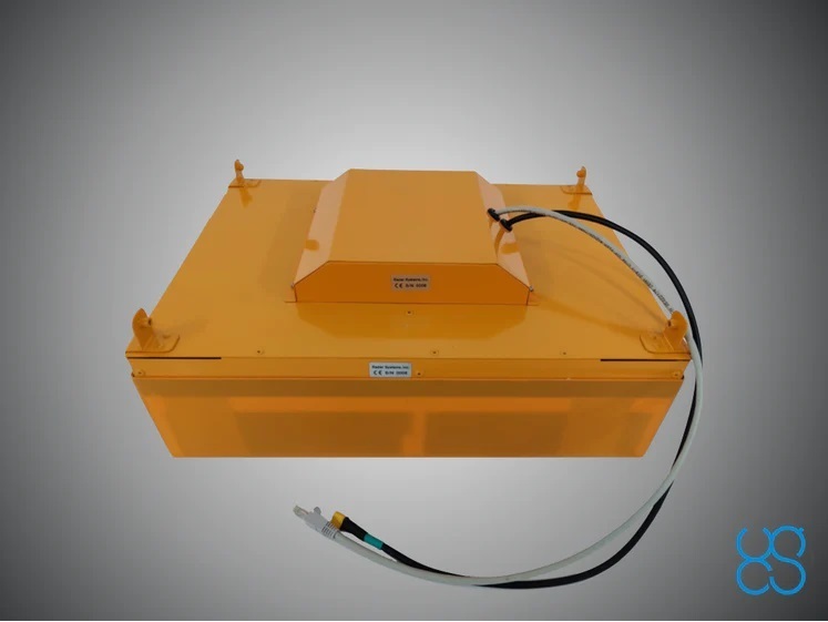


18,847.00 €
The price includes VAT
Delivery weight: 10 kg
New
Browse this category:
UgCS__Sistemas_integrados
SENSYS MagDrone R3 magnetometer
Currently unavailable
Notify on availability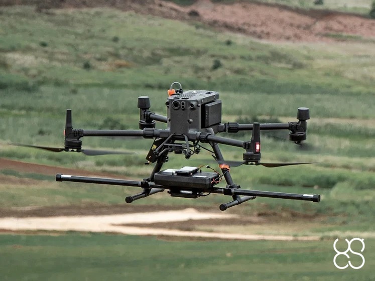

18,487.00 €
The price includes VAT
Delivery weight: 10 kg
Water sampler bundle
Currently unavailable
Notify on availability
13,909.00 €
The price includes VAT
Delivery weight: 3 kg
Water sampler bundle
PRODUCT ON REQUEST
CONTACT shop@stockrc.com


slide 1 of 7


slide 1 of 1


slide 1 of 18


slide 1 of 1


slide 1 of 6


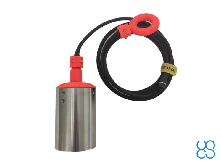
Despite the rapid progress with different sensors allowing the analysis of water contamination, turbidity, etc. in-situ, water sampling for subsequent analysis in the laboratory will stay widespread in the foreseeable future.
Traditional methods require direct access to the water body and samples are gathered from the shore, pier, bridge, or boat. Acquiring samples at some distance from the bank without a boat or ship is impossible.
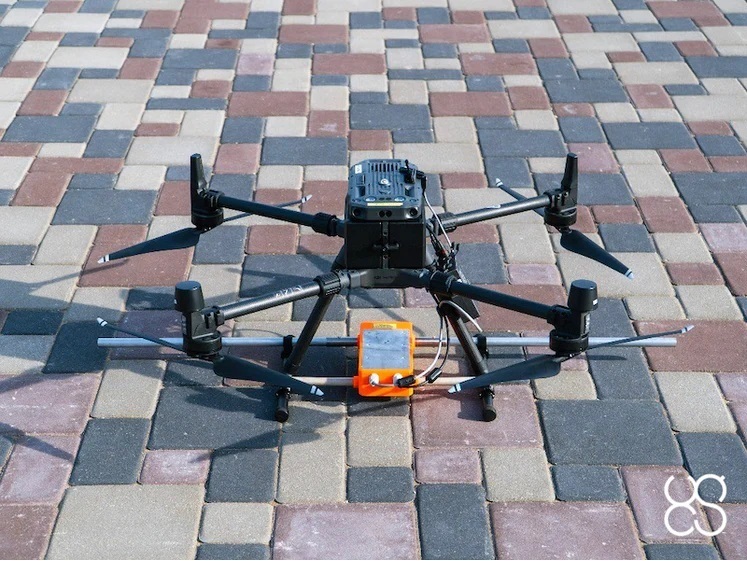
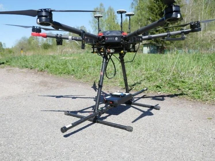
A remote sampling system fully integrated with a UAV solves this problem, allowing water sampling at long distances from the shore.
The system consists of:
-
Ruttner water sampler with volume 1L for DJI M300RTK or up to 5l for heavy lift drones.
-
Onboard computer SkyHub enables to control water sampling process in a fully automatic mode. Water sampling missions are planned and flown in automatic mode with UgCS.
-
Radar or laser altimeter for real-time altitude measurement during the flight to the sampling location where it is necessary to take a sample, and also to control the descent to the required altitude to take a sample from a set depth.
-
The only specific component developed for the water sampling system is the messenger release device.
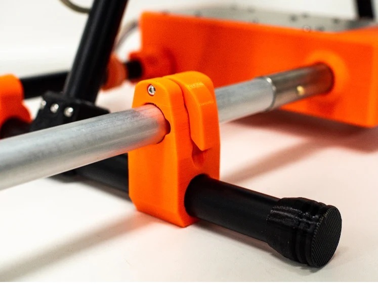
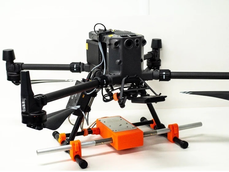
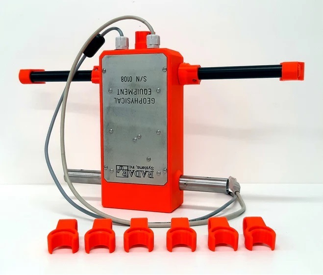
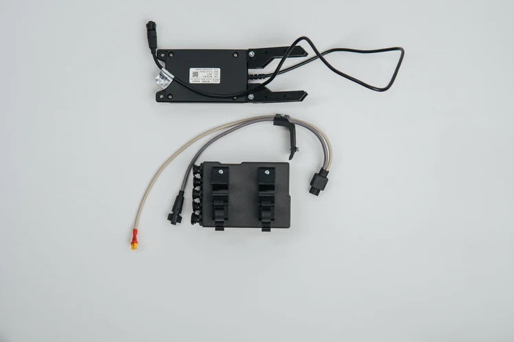
Universal heavy lift payload mounting for DJI M300/M350 RTK drone
Ecosonda EchoLogger ECT D052S
Currently unavailable
Notify on availability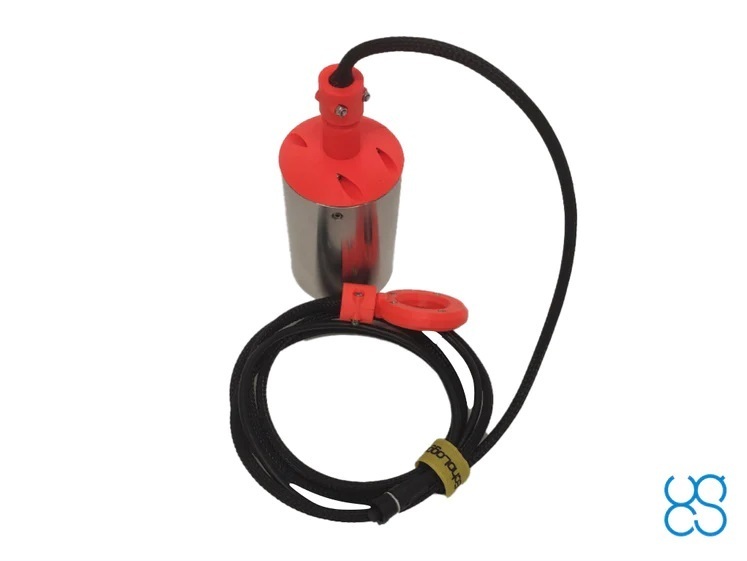

11,181.00 €
The price includes VAT
Delivery weight: 2 kg
New
Browse this category:
UgCS__Sistemas_integrados
True Terrain Following kit for DJI drones
Currently unavailable
Notify on availability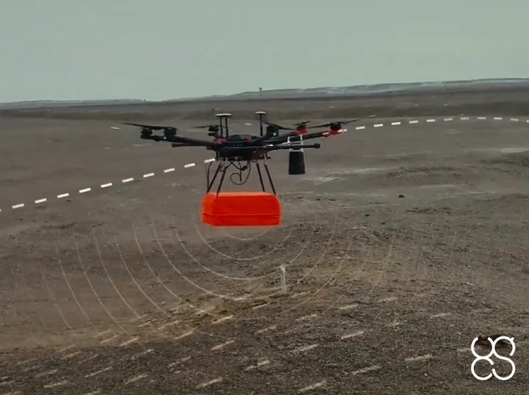


10,103.00 €
The price includes VAT
Delivery weight: 5 kg
EchoLogger ECT 400S echo sounder
Currently unavailable
Notify on availability

8,773.00 €
The price includes VAT
Delivery weight: 3 kg